 Old Cumbria Gazetteer
 |
 |
|
| Rigghead Quarries, Borrowdale | ||
| Rigghead Quarries | ||
| civil parish:- | Borrowdale (formerly Cumberland) | |
| county:- | Cumbria | |
| locality type:- | slate quarry | |
| locality type:- | quarry | |
| coordinates:- | NY23671526 (etc etc) | |
| 1Km square:- | NY2315 | |
| 10Km square:- | NY21 | |
|
|
||
 BOK78.jpg (taken 19.1.2008) 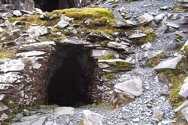 BOK79.jpg (taken 19.1.2008) |
||
|
|
||
| evidence:- | old map:- OS County Series (Cmd 70 9) placename:- Rigghead Quarries |
|
| source data:- | Maps, County Series maps of Great Britain, scales 6 and 25
inches to 1 mile, published by the Ordnance Survey, Southampton,
Hampshire, from about 1863 to 1948. "Rigghead Quarries" |
|
|
|
||
| evidence:- | old map:- Gents Mag 1751 item:- slate |
|
| source data:- | Map, uncoloured engraving, Map of the Black Lead Mines in
Cumberland, and area, scale about 2 miles to 1 inch, by George
Smith, published in the Gentleman's Magazine, 1751.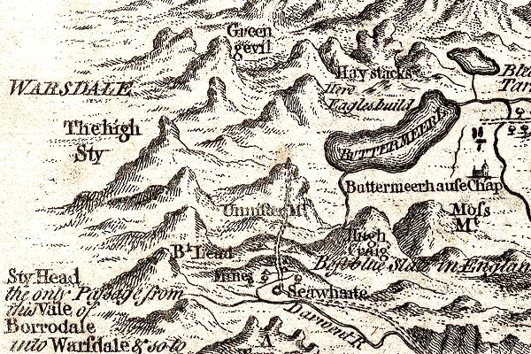 GM1305.jpg "Best blue Slate in England" on 'High Craig'. item:- JandMN : 114 Image © see bottom of page |
|
|
|
||
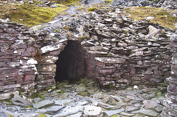
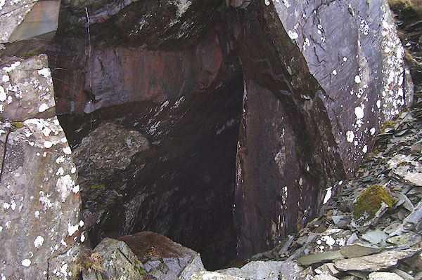
| evidence:- | old text:- Postlethwaite 1877 (3rd edn 1913) placename:- Rigg Head Quarry item:- slate |
|
| source data:- | Book, Mines and Mining in the English Lake District, by John Postlethwaite, Keswick,
published by W H Moss and Sons, Whitehaven, Cumberland now Cumbria, 1877; published
1877-1913. goto source goto sourcepage 135:- "..." "Rigg Head Quarry was opened by William Layland about 45 years ago, and the work is still carried on by his sons, and during that time a large quantity of slate of very good quality has been obtained." |
|
|
|
||
 BOK80.jpg (taken 19.1.2008) 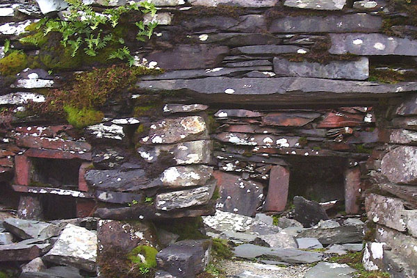 BOK81.jpg (taken 19.1.2008) 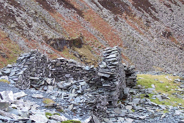 BOK82.jpg (taken 19.1.2008)  BOK84.jpg (taken 19.1.2008) |
||
|
|
||
| Glover, David: 2014: Quarries of Lakeland: Bookcase (Carlisle, Cumbria) |
||
|
|
||
Lakes Guides menu.