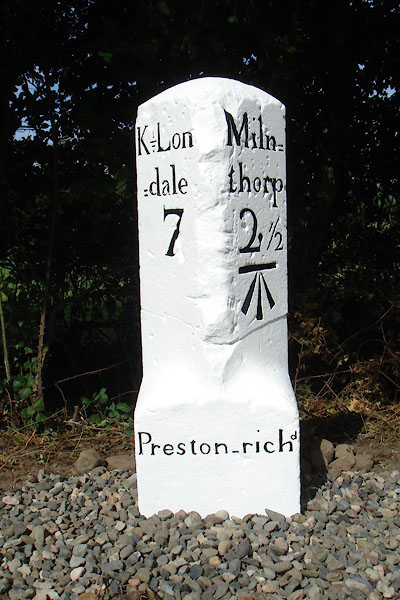


CGX66.jpg Inscribed stone:-
"K=Lon / =dale / 7 / Miln= / thorp / 2½ / Preston-richd" (taken 11.2017) courtesy of David Gosling
"M.S. Milnthorpe .. 2 1/2 Kirkby Lonsdale .. 7"
courtesy of English Heritage
"MILESTONE APPROXIMATELY 200 YARDS SOUTH WEST OF LANE FARM / / B6385 / PRESTON RICHARD / SOUTH LAKELAND / CUMBRIA / II / 76524 / SD5254483406"
courtesy of English Heritage
"Milestone. Probably early C19. Dressed limestone upright stone with round head and wide stop chamfers to front corners. Painted black and white and inscribed:"
"K = Lon / = dale / 3 on West and"
"Miln = / thorpe 2 1/2"
"on East"
"The 3 on the West side has been painted over with a 7 (the correct distance). Bench-mark on the East side. Worn inscription on base probably reads "To London"."

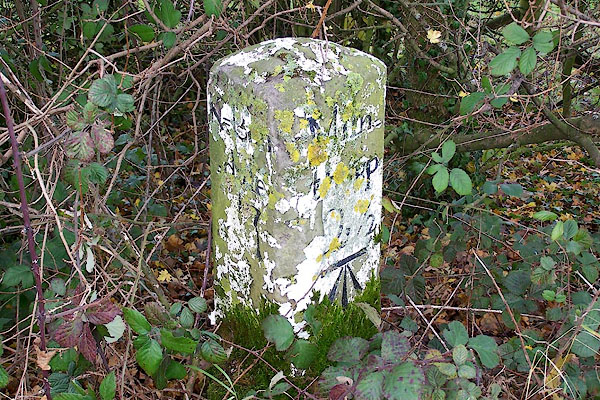
BOJ14.jpg Inscribed stone (before restoration) :-
"K=Lon[ ] / =dale / 7 / Miln= / thorp / 2½" (taken 24.11.2007)

 Lakes Guides menu.