 Old Cumbria Gazetteer
 |
 |
|
| boundary stone, Heversham/Milnthorpe | ||
| Street:- | Rowell Lane | |
| civil parish:- | Heversham (formerly Westmorland) | |
| civil parish:- | Milnthorpe (formerly Westmorland) | |
| county:- | Cumbria | |
| locality type:- | boundary stone | |
| locality type:- | parish boundary mark | |
| coordinates:- | SD50938284 | |
| 1Km square:- | SD5082 | |
| 10Km square:- | SD58 | |
|
|
||
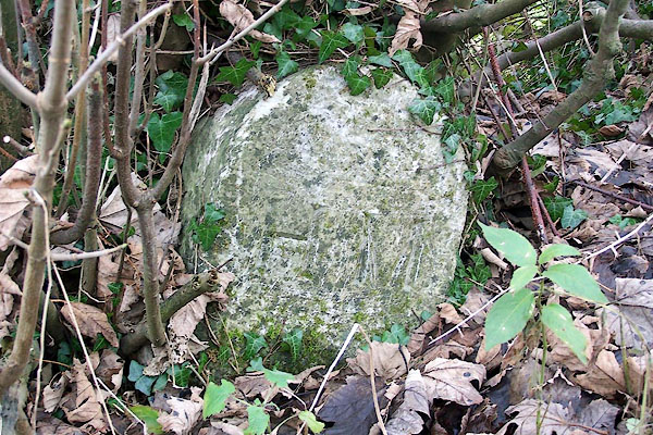 BOJ13.jpg Inscribed stone:- "H M" Heversham Milnthorpe (taken 24.11.2007) |
||
|
|
||
| evidence:- | database:- Listed Buildings 2010 |
|
| source data:- | courtesy of English Heritage "BOUNDARY STONE AT THE JUNCTION OF ROWELL LANE WITH WOODHOUSE- ACKENTHWAITE ROAD APPROXIMATELY 600 METRES SOUTH OF WOODHOUSE / / ROWELL LANE / MILNTHORPE / SOUTH LAKELAND / CUMBRIA / II / 75566 / SD5093682832" |
|
| source data:- | courtesy of English Heritage "BOUNDARY STONE AT THE JUNCTION OF ROWELL LANE WITH WOODHOUSE TO ACKENTHWAITE ROAD APPROXIMATELY 600 YARDS SOUTH OF WOODHOUSE / / ROWELL LANE / HEVERSHAM / SOUTH LAKELAND / CUMBRIA / II / 76516 / SD5093782832" |
|
| source data:- | courtesy of English Heritage "Boundary stone. Probably mid C19. Limestone upright slab with round head. Hammer-dressed face with tooled margins and dressed central panel with HM incised in sans-serif lettering. (Also listed under Heversham Parish)." |
|
|
|
||
 Lakes Guides menu.