 Old Cumbria Gazetteer
 |
 |
|
| St Lawrence, Broughton | ||
| St Lawrence's Chapel | ||
| civil parish:- | Broughton (formerly Cumberland) | |
| county:- | Cumbria | |
| locality type:- | church (site) | |
| locality type:- | chapel (site) | |
| coordinates:- | NY06073049 (approx) | |
| 1Km square:- | NY0630 | |
| 10Km square:- | NY03 | |
|
|
||
| evidence:- | old map:- OS County Series (Cmd 54 1) placename:- St Lawrence's Chapel |
|
| source data:- | Maps, County Series maps of Great Britain, scales 6 and 25
inches to 1 mile, published by the Ordnance Survey, Southampton,
Hampshire, from about 1863 to 1948. "St. Lawrence's Chapel (Site of) / Grave Yard" |
|
|
|
||
| evidence:- | old map:- Saxton 1579 placename:- St Lawrance |
|
| source data:- | Map, hand coloured engraving, Westmorlandiae et Cumberlandiae Comitatus ie Westmorland
and Cumberland, scale about 5 miles to 1 inch, by Christopher Saxton, London, engraved
by Augustinus Ryther, 1576, published 1579-1645.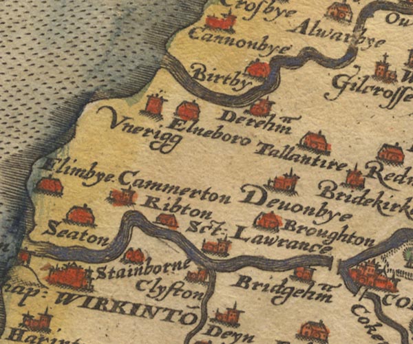 Sax9NY03.jpg Church, symbol for a parish or village, with a parish church. "Sct: Lawrance" item:- private collection : 2 Image © see bottom of page |
|
|
|
||
| evidence:- | old map:- Speed 1611 (Cmd) placename:- St Lawrance |
|
| source data:- | Map, hand coloured engraving, Cumberland and the Ancient Citie
Carlile Described, scale about 4 miles to 1 inch, by John Speed,
1610, published by J Sudbury and George Humble, Popes Head
Alley, London, 1611-12. SP11NY02.jpg "S. Lawrance" circle, tower AND circle, building, tower; at confluence of Marron and Derwent item:- private collection : 16 Image © see bottom of page |
|
|
|
||
| evidence:- | old map:- Jansson 1646 placename:- St Lawrance |
|
| source data:- | Map, hand coloured engraving, Cumbria and Westmoria, ie
Cumberland and Westmorland, scale about 3.5 miles to 1 inch, by
John Jansson, Amsterdam, Netherlands, 1646.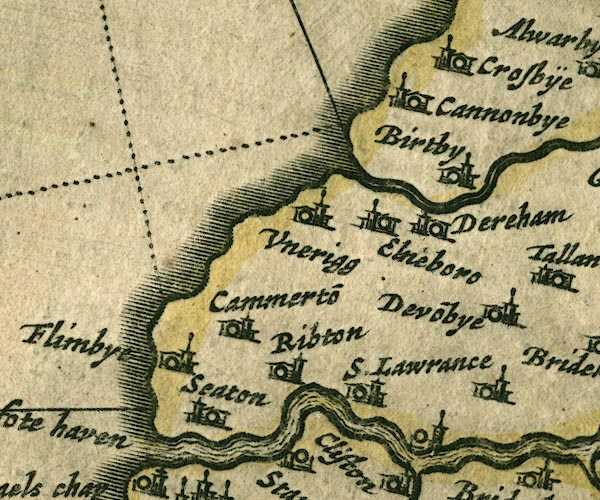 JAN3NY03.jpg "S. Lawrance" Buildings and tower. item:- JandMN : 88 Image © see bottom of page |
|
|
|
||
| evidence:- | old map:- Morden 1695 (Cmd) |
|
| source data:- | Map, uncoloured engraving, Cumberland, scale about 4 miles to 1
inch, by Robert Morden, 1695, published by Abel Swale, the
Unicorn, St Paul's Churchyard, Awnsham, and John Churchill, the
Black Swan, Paternoster Row, London, 1695-1715.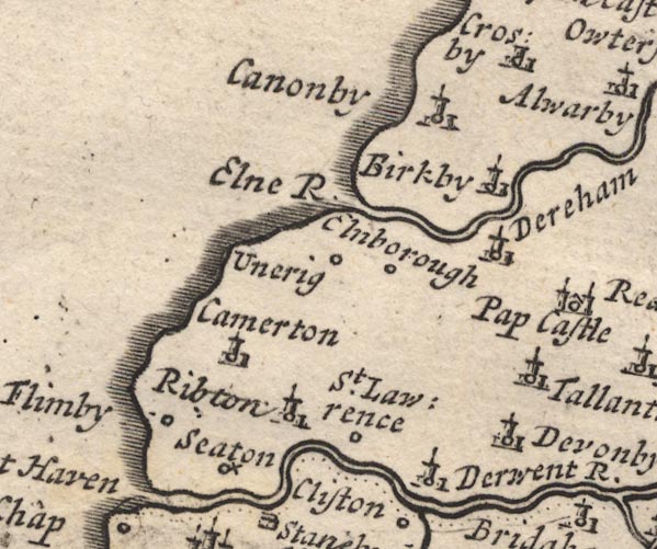 MD12NY03.jpg "" Circle, building and tower, unlabelled. item:- JandMN : 90 Image © see bottom of page |
|
|
|
||
| evidence:- | old map:- Bowen and Kitchin 1760 placename:- St Lawrence |
|
| source data:- | Map, hand coloured engraving, A New Map of the Counties of
Cumberland and Westmoreland Divided into their Respective Wards,
scale about 4 miles to 1 inch, by Emanuel Bowen and Thomas
Kitchin et al, published by T Bowles, Robert Sayer, and John
Bowles, London, 1760.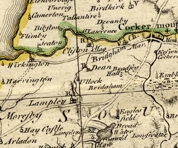 BO18NY02.jpg "St Lawrence" circle item:- Armitt Library : 2008.14.10 Image © see bottom of page |
|
|
|
||
 Lakes Guides menu.