 Old Cumbria Gazetteer
 |
 |
|
| roman fort, Westward | ||
| perhaps | ||
| civil parish:- | Westward (formerly Cumberland) | |
| county:- | Cumberland | |
| locality type:- | roman fort | |
| coordinates:- | NY283422 (about) | |
| 1Km square:- | NY2842 | |
| 10Km square:- | NY24 | |
| references:- | Morden 1695 |
|
|
|
||
| evidence:- | old map:- Morden 1695 (Cmd) placename:- Castra Exploratorum |
|
| source data:- | Map, uncoloured engraving, Cumberland, scale about 4 miles to 1
inch, by Robert Morden, 1695, published by Abel Swale, the
Unicorn, St Paul's Churchyard, Awnsham, and John Churchill, the
Black Swan, Paternoster Row, London, 1695-1715.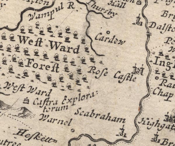 MD12NY34.jpg "Castra Exploratorum" Drawing of a house. item:- JandMN : 90 Image © see bottom of page |
|
|
|
||
| evidence:- | old map:- Badeslade 1742 placename:- Castra Exploratorum |
|
| source data:- | Map, uncoloured engraving, A Map of Cumberland North from
London, scale about 11 miles to 1 inch, with descriptive text,
by Thomas Badeslade, London, engraved and published by William
Henry Toms, Union Court, Holborn, London, 1742. click to enlarge click to enlargeBD10.jpg "Castra Exploratorum" circle, italic lowercase text; roman fort, on a hillock item:- JandMN : 115 Image © see bottom of page |
|
|
|
||
| evidence:- | old map:- Donald 1774 (Cmd) placename:- Castra Exploratorum |
|
| source data:- | Map, hand coloured engraving, 3x2 sheets, The County of Cumberland, scale about 1
inch to 1 mile, by Thomas Donald, engraved and published by Joseph Hodskinson, 29
Arundel Street, Strand, London, 1774.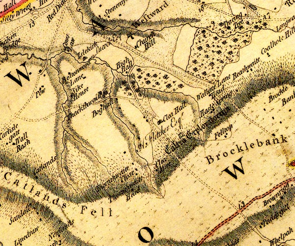 D4NY24SE.jpg "Castra Exploratorum" square within a square; roman fort item:- Carlisle Library : Map 2 Image © Carlisle Library |
|
|
|
||
 Lakes Guides menu.