 Old Cumbria Gazetteer
 |
 |
|
| mine, Kaber | ||
| locality:- | Taylor Rigg | |
| civil parish:- | Kaber (formerly Westmorland) | |
| county:- | Cumbria | |
| locality type:- | coal mine | |
| locality type:- | mine | |
| coordinates:- | NY890076 (guess) | |
| 1Km square:- | NY8907 | |
| 10Km square:- | NY80 | |
| SummaryText:- | One of several areas of 'old pits' | |
|
|
||
| evidence:- | old map:- Morden 1695 (Wmd) |
|
| source data:- | Map, hand coloured engraving, Westmorland, scale about 2.5 miles to 1 inch, by Robert
Morden, published by Abel Swale, the Unicorn, St Paul's Churchyard, Awnsham, and John
Churchill, the Black Swan, Paternoster Row, London, 1695.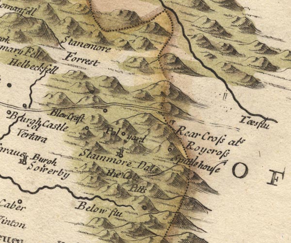 MD10NY81.jpg "the Cole Pitts" Circle on the side of a hillock. item:- JandMN : 24 Image © see bottom of page |
|
|
|
||
| evidence:- | old map:- Simpson 1746 map (Wmd) |
|
| source data:- | Map, uncoloured engraving, Westmorland, scale about 8 miles to 1
inch, printed by R Walker, Fleet Lane, London, 1746. SMP2NYV.jpg "The Coat Pitts" item:- Dove Cottage : 2007.38.59 Image © see bottom of page |
|
|
|
||
| evidence:- | perhaps old map:- Jefferys 1770 (Wmd) |
|
| source data:- | Map, 4 sheets, The County of Westmoreland, scale 1 inch to 1
mile, surveyed 1768, and engraved and published by Thomas
Jefferys, London, 1770.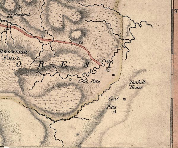 J5NY80NE.jpg "Coal Pitts" 'diggings' item:- National Library of Scotland : EME.s.47 Image © National Library of Scotland |
|
|
|
||
| evidence:- | perhaps old map:- Cary 1789 (edn 1805) |
|
| source data:- | Map, uncoloured engraving, Westmoreland, scale about 2.5 miles
to 1 inch, by John Cary, London, 1789; edition 1805.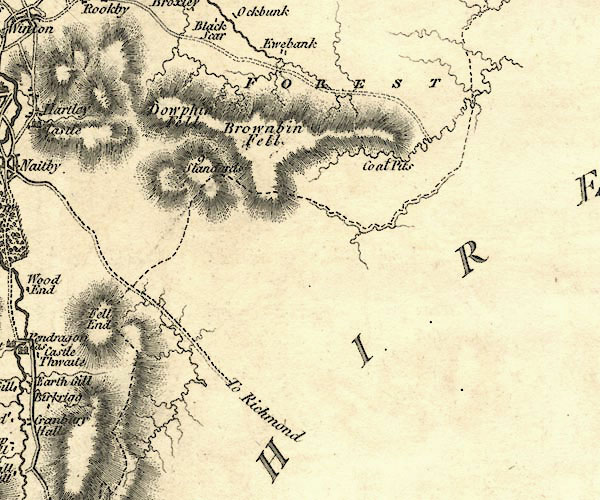 CY24NY80.jpg "Coal Pits" circle item:- JandMN : 129 Image © see bottom of page |
|
|
|
||
 Lakes Guides menu.