 Old Cumbria Gazetteer
 |
 |
|
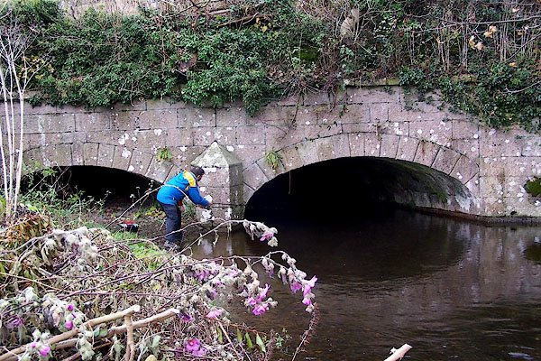
| Crooklands Aqueduct, Lancaster Canal | ||
| Crooklands Aqueduct | ||
| bridge no.165 | ||
| site name:- | Lancaster Canal | |
| site name:- | Peasey Beck | |
| locality:- | Crooklands | |
| civil parish:- | Preston Patrick (formerly Westmorland) | |
| civil parish:- | Preston Richard (formerly Westmorland) | |
| county:- | Cumbria | |
| locality type:- | canal aqueduct | |
| locality type:- | aqueduct | |
| coordinates:- | SD53478338 | |
| 1Km square:- | SD5383 | |
| 10Km square:- | SD58 | |
|
|
||
 BOJ15.jpg (taken 24.11.2007) |
||
|
|
||
| evidence:- | old map:- OS County Series (Wmd 43 13) |
|
| source data:- | Maps, County Series maps of Great Britain, scales 6 and 25
inches to 1 mile, published by the Ordnance Survey, Southampton,
Hampshire, from about 1863 to 1948. "Aqueduct" |
|
|
|
||
| evidence:- | database:- Listed Buildings 2010 |
|
| source data:- | courtesy of English Heritage "AQUEDUCT CARRYING KENDAL/LANCASTER CANAL OVER PEASY BECK / / MILTON LANE / PRESTON PATRICK / SOUTH LAKELAND / CUMBRIA / II / 76629 / SD5347583378" |
|
| source data:- | courtesy of English Heritage "AQUEDUCT CARRYING KENDAL LANCASTER CANAL OVER PEASEY BECK NGR 5348 8350 / / / PRESTON RICHARD / SOUTH LAKELAND / CUMBRIA / II / 76527 / SD5348083372" |
|
| source data:- | courtesy of English Heritage "Aqueduct c1818. Squared, coursed limestone with limestone copings and string course. 2 shallow elliptical arches with rusticated voussoirs; central cutwater; curved retaining walls to either side. Approx. 30 ft wide. At angle to direction of canal." |
|
|
|
||
 Lakes Guides menu.