 Old Cumbria Gazetteer
 |
 |
|
| Criffel, Scotland | ||
| Criffel | ||
| country:- | Scotland | |
| locality type:- | hill | |
| coordinates:- | NX957619 | |
| 1Km square:- | NX9561 | |
| 10Km square:- | NX96 | |
|
|
||
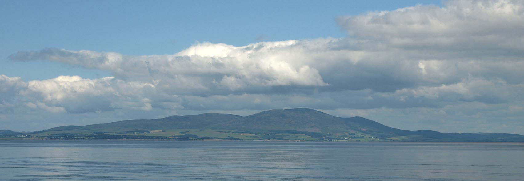 Click to enlarge BRA87.jpg From Silloth. (taken 10.7.2009) |
||
|
|
||
| evidence:- | poem:- Drayton 1612/1622 text placename:- Scurfell item:- viewpoint |
|
| source data:- | Poem, Poly Olbion, by Michael Drayton, published by published by
John Marriott, John Grismand and Thomas Dewe, and others?
London, part 1 1612, part 2 1622. goto source goto sourcepage 165:- "... Scurfell from the skie, That Anadale doth crowne, ..." |
|
|
|
||
| evidence:- | old print:- Clarke 1787 placename:- Criffel |
|
| source data:- | Topograph, the view from Penrith Beacon, Cumberland, by James
Clarke, published by James Clarke, London, 1787.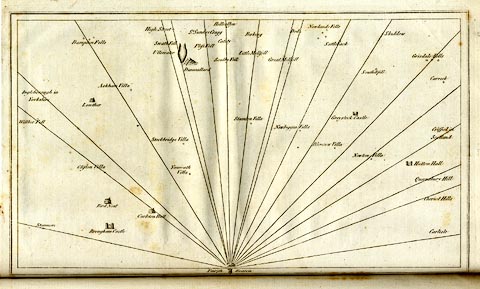 click to enlarge click to enlargeCL18.jpg "Criffel in Scotland" item:- Armitt Library : A6615.12 Image © see bottom of page |
|
|
|
||
| evidence:- | descriptive text:- Clarke 1858 placename:- Criffel |
|
| source data:- | Report, Account of the Observations and Calculations of the
Principal Triangulation, by Captain Alexander Ross Clarke,
published by the Ordnance Survey, London, 1858. "CRIFFEL, 1841. This station is on top and close to the south-west edge of 'Douglas Cairn,' which is on the highest part of the well-known mountain named Criffel, 10 miles south of Dumfries, and 3 miles south of the village of New Abbey. It is marked by a hole in the solid rock, in the centre of a square formed by four pickets on which rested the instrument. A wall runs over the top of the mountain in a north-east and south-west direction, forming an angle near the station, which is 80 feet due east from the nearest point of the wall." Altitude above mean sea level:- "1866.6 feet" Position, latitude and longitude, degrees minutes decimal seconds "54 56 26.38 / 3 37 37.16" |
|
|
|
||
| evidence:- | old print:- |
|
| source data:- | Print, hand coloured engraving, Entrance to Silloth Bay and Dock, Cumberland, published
by Hudson Scott, litho printer, Carlisle, Cumbria, 1870.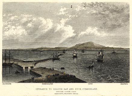 click to enlarge click to enlargePR0369.jpg There is shipping in the offing and at the dock, a train leaving the quay; some scottish coastal features are labelled - Lee Scar lighthouse, Southerness lighthouse, Criffel and Carse Thorn. printed at bottom:- "ENTRANCE TO SILLOTH BAY AND DOCK, CUMBERLAND. / OPPOSITE THE SCOTCH COAST / HUDSON SCOTT, LITHO PRINTER CARLISLE." item:- Dove Cottage : 2008.107.369 Image © see bottom of page |
|
|
|
||
| evidence:- | old print:- |
|
| source data:- | Print, uncoloured engraving, Maryport, Cumberland, drawn by W H Bartlett, engraved
by J C Armytage, published 1840s.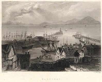 click to enlarge click to enlargePR0075.jpg Probably from Findens Views of the Ports, Harbours, Coast Scenery, and Watering Places of Great Britain, as continued by W H Bartlett. printed at bottom left, right, centre:- "W. H. Bartlett. / J. C. Armytage. / MARYPORT." item:- Dove Cottage : 2008.107.75 Image © see bottom of page |
|
|
|
||
Lakes Guides menu.