 Old Cumbria Gazetteer
 |
 |
|
| Whelprigg, Barbon | ||
| Whelprigg | ||
| civil parish:- | Barbon (formerly Westmorland) | |
| county:- | Cumbria | |
| locality type:- | buildings | |
| coordinates:- | SD63358129 | |
| 1Km square:- | SD6381 | |
| 10Km square:- | SD68 | |
|
|
||
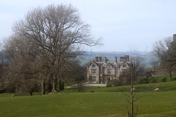 CFY25.jpg (taken 24.3.2017) 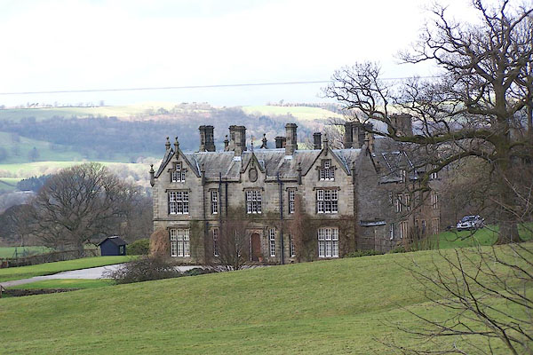 BNH20.jpg (taken 2.3.2007) |
||
|
|
||
| evidence:- | old map:- OS County Series (Wmd 48 1) placename:- Whelprigg |
|
| source data:- | Maps, County Series maps of Great Britain, scales 6 and 25
inches to 1 mile, published by the Ordnance Survey, Southampton,
Hampshire, from about 1863 to 1948. |
|
|
|
||
| evidence:- | old map:- Jefferys 1770 (Wmd) placename:- Whilp Rigg |
|
| source data:- | Map, 4 sheets, The County of Westmoreland, scale 1 inch to 1
mile, surveyed 1768, and engraved and published by Thomas
Jefferys, London, 1770.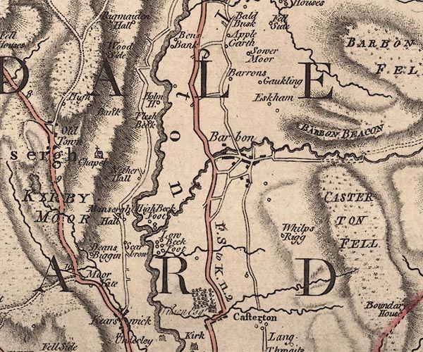 J5SD68SW.jpg "Whilp Rigg" circle, labelled in italic lowercase text; settlement, farm, house, or hamlet? item:- National Library of Scotland : EME.s.47 Image © National Library of Scotland |
|
|
|
||
| evidence:- | database:- Listed Buildings 2010 placename:- Whelprigg item:- date stone (1700) |
|
| source data:- | courtesy of English Heritage "WHELPRIGG / / / BARBON / SOUTH LAKELAND / CUMBRIA / II / 75584 / SD6334981290" |
|
|
|
||
| evidence:- | database:- Listed Buildings 2010 item:- date stone |
|
| source data:- | courtesy of English Heritage "LODGE TO WHELPRIGG / / / CASTERTON / SOUTH LAKELAND / CUMBRIA / II / 75605 / SD6263281205" |
|
|
|
||
| evidence:- | database:- Listed Buildings 2010 item:- date stone |
|
| source data:- | courtesy of English Heritage "STABLES HOUSE AND GARDEN WALL IMMEDIATELY TO NORTH EAST OF WHELPRIGG / / / BARBON / SOUTH LAKELAND / CUMBRIA / II / 75585 / SD6343781346" |
|
|
|
||
 Lakes Guides menu.