 Old Cumbria Gazetteer
 |
 |
|
| Thwaite Head Bridge, Thwaite Head | ||
| Thwaite Head Bridge | ||
| Ashes Bridge | ||
| site name:- | Ashes Beck | |
| locality:- | Thwaite Head | |
| civil parish:- | Colton (formerly Lancashire) | |
| county:- | Cumbria | |
| locality type:- | bridge | |
| coordinates:- | SD34679045 | |
| 1Km square:- | SD3490 | |
| 10Km square:- | SD39 | |
|
|
||
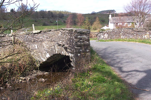 BNN22.jpg (taken 5.4.2007) 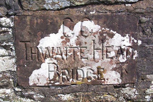 BNN23.jpg Sandstone plaque:- "C.C. / THWAITE HEAD / BRIDGE" and bench mark. (taken 5.4.2007) |
||
|
|
||
| evidence:- | old map:- OS County Series (Lan 8) placename:- Ashes Bridge placename:- Thwaite Head Bridge |
|
| source data:- | Maps, County Series maps of Great Britain, scales 6 and 25
inches to 1 mile, published by the Ordnance Survey, Southampton,
Hampshire, from about 1863 to 1948. "Ashes Bridge or Thwaite Head Bridge" |
|
|
|
||
 Lakes Guides menu.