 Old Cumbria Gazetteer
 |
 |
|
| Stockdale Bank Quarry, Longsleddale | ||
| Stockdale Bank Quarry | ||
| Brock Crag Quarry | ||
| locality:- | Brock Crag | |
| locality:- | Great Howe | |
| locality:- | Stockdale | |
| civil parish:- | Longsleddale (formerly Westmorland) | |
| county:- | Cumbria | |
| locality type:- | quarry | |
| coordinates:- | NY48910571 (etc) | |
| 1Km square:- | NY4805 | |
| 10Km square:- | NY40 | |
| SummaryText:- | The name may not be 'original'. | |
|
|
||
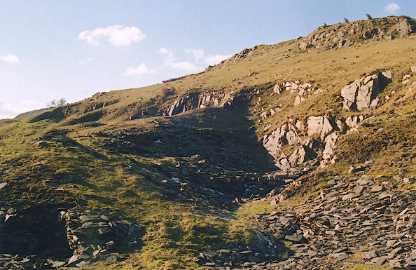 BIL37.jpg (taken 29.2.2004) 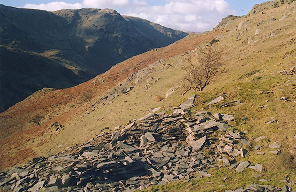 BIM07.jpg (taken 29.2.2004) |
||
|
|
||
| evidence:- | old map:- OS County Series (Wmd 27 7) |
|
| source data:- | Maps, County Series maps of Great Britain, scales 6 and 25
inches to 1 mile, published by the Ordnance Survey, Southampton,
Hampshire, from about 1863 to 1948. "Old Quarries" |
|
|
|
||
| evidence:- | map:- OS Six Inch (1956) |
|
| source data:- | Map series, various editions with the national grid, scale about
6 inches to 1 mile, published by the Ordnance Survey,
Southampton, Hampshire, scale 1 to 10560 from 1950s to 1960s,
then 1 to 10000 from 1960s to 2000s, superseded by print on
demand from digital data.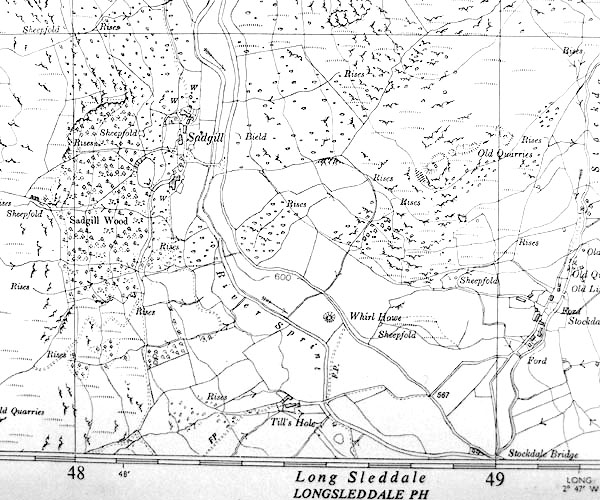 SINY4805.jpg "Old Quarries" |
|
|
|
||
 BIM06.jpg (taken 29.2.2004) 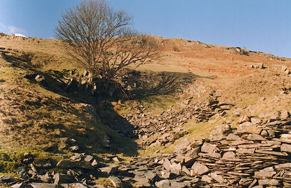 BIL34.jpg (taken 29.2.2004)  BQT35.jpg Sledge route from the quarry, at the Stockdale path end. (taken 9.6.2009) |
||
|
|
||
|
|
||
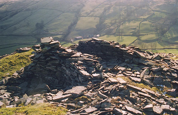
| hearsay:- |
Probably active 1724-80, making roof slates. Minor excavations along the 950 foot
contour; possibly remains of a riving shed. There is a sledge route from the quarries
to the Stockdale track. |
|
|
|
||
| Glover, David: 2014: Quarries of Lakeland: Bookcase (Carlisle, Cumbria) |
||
|
|
||
 Lakes Guides menu.