 Old Cumbria Gazetteer
 |
 |
|
| Sosgill Bridge, St John's Castlerigg etc | ||
| Sosgill Bridge | ||
| site name:- | St John's Beck | |
| locality:- | St John's in the Vale | |
| civil parish:- | St John's Castlerigg and Wythburn (formerly Cumberland) | |
| county:- | Cumbria | |
| locality type:- | bridge | |
| coordinates:- | NY31572105 | |
| 1Km square:- | NY3121 | |
| 10Km square:- | NY32 | |
|
|
||
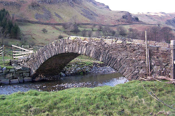 BND92.jpg Leading to Sosgill. (taken 5.2.2007) |
||
|
|
||
| evidence:- | old map:- OS County Series (Cmd 64 12) placename:- Sosgill Bridge |
|
| source data:- | Maps, County Series maps of Great Britain, scales 6 and 25
inches to 1 mile, published by the Ordnance Survey, Southampton,
Hampshire, from about 1863 to 1948. |
|
|
|
||
| evidence:- | old map:- Donald 1774 (Cmd) |
|
| source data:- | Map, hand coloured engraving, 3x2 sheets, The County of Cumberland, scale about 1
inch to 1 mile, by Thomas Donald, engraved and published by Joseph Hodskinson, 29
Arundel Street, Strand, London, 1774.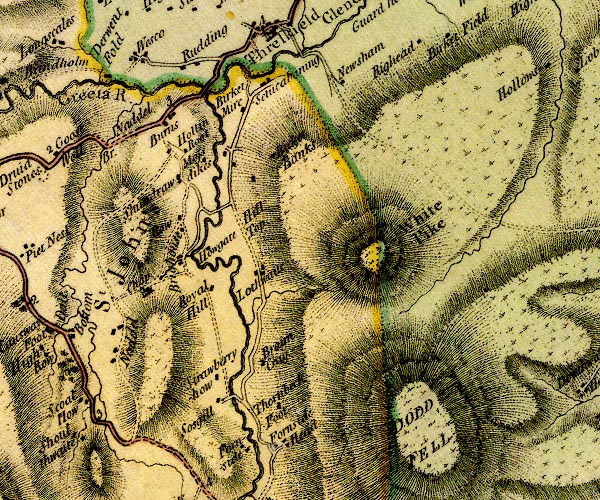 D4NY32SW.jpg double line across a river; a bridge at Sosgill item:- Carlisle Library : Map 2 Image © Carlisle Library |
|
|
|
||
| evidence:- | old print:- Green 1814 (plate 27) placename:- Soskeld Bridge |
|
| source data:- | Print, tinted soft ground etching, Soskeld Bridge, St John's in the Vale, St John's
Castlerigg and Wythburn, Cumberland, by William Green, Ambleside, Westmorland, 1814.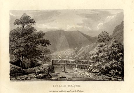 click to enlarge click to enlargeGN1027.jpg Sosgill Bridge on the St John's Beck. Plate 27 in Sixty Small Prints. printed at top right:- "27" printed at bottom:- "SOSKELD BRIDGE. / Published at Ambleside Augst. 1, 1814, by Wm. Green." item:- Armitt Library : A6653.27 Image © see bottom of page |
|
|
|
||
| evidence:- | old print:- Green 1814 (plate 27) placename:- Soskeld Bridge |
|
| source data:- | Print, uncoloured soft ground etching, Soskeld Bridge, St John's in the Vale, St John's
Castlerigg and Wythburn, Cumberland, by William Green, Ambleside, Westmorland, 1814.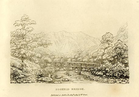 click to enlarge click to enlargeGN0927.jpg Sosgill Bridge on the St John's Beck. Plate 27 in Sixty Small Prints. printed at top right:- "27" printed at bottom:- "SOSKELD BRIDGE. / Published at Ambleside Augst. 1, 1814, by Wm. Green." item:- Armitt Library : A6656.27 Image © see bottom of page |
|
|
|
||
| evidence:- | old text:- Green 1814 placename:- Soskeld Bridge |
|
| source data:- | Set of prints, soft ground etchings, Sixty Small Prints, with
text, A Description of a Series of Sixty Small Prints, by
William Green, Ambleside, Westmorland, 1814. goto source goto sourcepage 15:- "..." "Soskeld Bridge is upon the Greta, about a mile below the Keswick road. ..." |
|
|
|
||
| evidence:- | perhaps old drawing:- Aspland 1840s-60s |
|
| source data:- | Drawing, pencil, Castle Rock, St John's in the Vale, Cumberland, by Theophilus Lindsey
Aspland, 1857.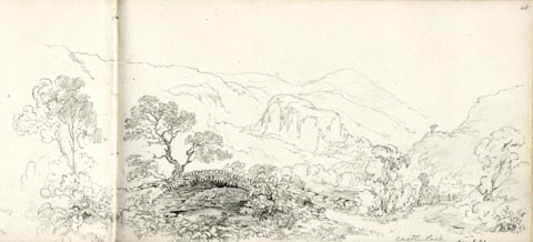 click to enlarge click to enlargeAS0551.jpg "Castle Rock / see p 41" page number "40" item:- Armitt Library : 1958.389.51 Image © see bottom of page |
|
|
|
||
| evidence:- | database:- Listed Buildings 2010 placename:- Sosgill Bridge |
|
| source data:- | courtesy of English Heritage "SOSGILL BRIDGE / / / ST JOHNS CASTLERIGG AND WYTHBURN / ALLERDALE / CUMBRIA / II / 72184 / NY3157521052" |
|
| source data:- | courtesy of English Heritage "Packhorse bridge. C18. Slate rubble. Narrow single-span segmental-arched humped-back bridge, with split slate voussoirs under solid parapets and rubble coping." |
|
|
|
||
| evidence:- | perhaps old print:- Green 1790s-1820s placename:- Sosgill Bridge item:- road |
|
| source data:- | Print, uncoloured soft ground etching, Soskeld Bridge, St John's Castlerigg and Wythburn,
Cumberland, drawn, engraved and published by William Green, Ambleside, Westmorland,
1820.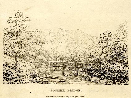 click to enlarge click to enlargePR0526.jpg Plate 27 from a Description of a Series of Sixty Small Prints. The hills in the background are Saddleback; this view is probably in St John's in the Vale where there is a Sosgill Bridge. But that bridge is a stone arch. Could the stone arch be a later replacement? printed at bottom:- "SOSKELD BRIDGE. / Published at Ambleside Augt, 1, 1814 by Wm. Green." item:- Dove Cottage : 2008.107.475 Image © see bottom of page |
|
|
|
||
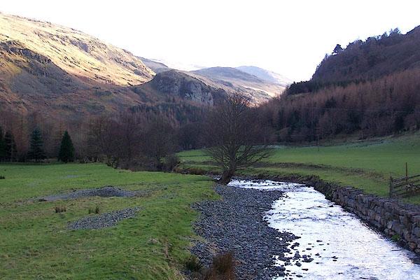 BND93.jpg View of river. (taken 5.2.2007) |
||
|
|
||
Lakes Guides menu.