 Old Cumbria Gazetteer
 |
 |
|
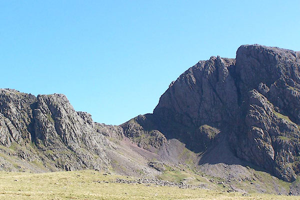
| Scafell Crag, Eskdale | ||
| Scafell Crag | ||
| site name:- | Sca Fell | |
| civil parish:- | Eskdale (formerly Cumberland) | |
| county:- | Cumbria | |
| locality type:- | rocks | |
| coordinates:- | NY20460685 (etc) | |
| 1Km square:- | NY2006 | |
| 10Km square:- | NY20 | |
|
|
||
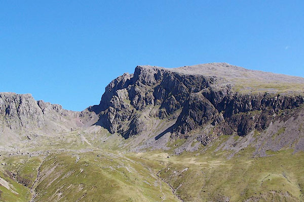 BQO29.jpg Scafell Crag, Mickledore and Hollowstones. (taken 12.5.2009) 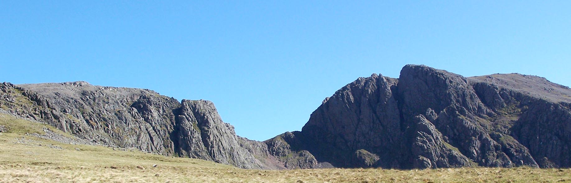 Click to enlarge BQO30.jpg Scafell Crag, Mickledore and Hollowstones. (taken 12.5.2009) |
||
|
|
||
| evidence:- | old map:- OS County Series (Cmd 74 16) placename:- Scafell Crag |
|
| source data:- | Maps, County Series maps of Great Britain, scales 6 and 25
inches to 1 mile, published by the Ordnance Survey, Southampton,
Hampshire, from about 1863 to 1948. |
|
|
|
||
| evidence:- | old photograph:- Bell 1880s-1940s |
|
| source data:- | Photograph, black and white, Sca Fell face, Eskdale, Cumberland, by Herbert Bell,
photographer, Ambleside, Westmorland, 1890s.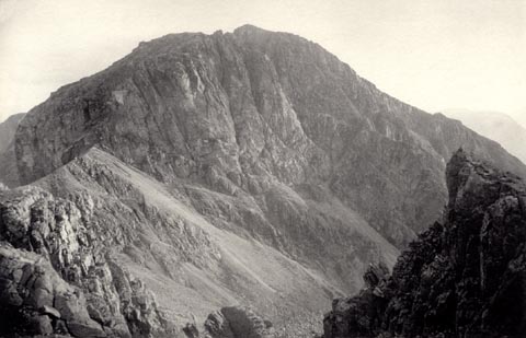 click to enlarge click to enlargeHB0884.jpg item:- Armitt Library : ALPS555 Image © see bottom of page |
|
|
|
||
| evidence:- | old photograph:- Bell 1880s-1940s |
|
| source data:- | Photograph, black and white, Sca Fell face and Mickledore, Eskdale, Cumberland, by
Herbert Bell, photographer, Ambleside, Westmorland, 1890s.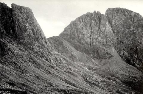 click to enlarge click to enlargeHB0907.jpg stamped at reverse:- "HERBERT BELL / Photographer / AMBLESIDE" item:- Armitt Library : ALPS582 Image © see bottom of page |
|
|
|
||
 BQO31.jpg Scafell Crag, Mickledore and Hollowstones. (taken 12.5.2009) |
||
|
|
||
 Lakes Guides menu.