 Old Cumbria Gazetteer
 |
 |
|
| Rannerdale, Buttermere | ||
| Rannerdale | ||
| Rannerdale Farm | ||
| civil parish:- | Buttermere (formerly Cumberland) | |
| county:- | Cumbria | |
| locality type:- | buildings | |
| locality type:- | locality | |
| coordinates:- | NY16301870 | |
| 1Km square:- | NY1618 | |
| 10Km square:- | NY11 | |
|
|
||
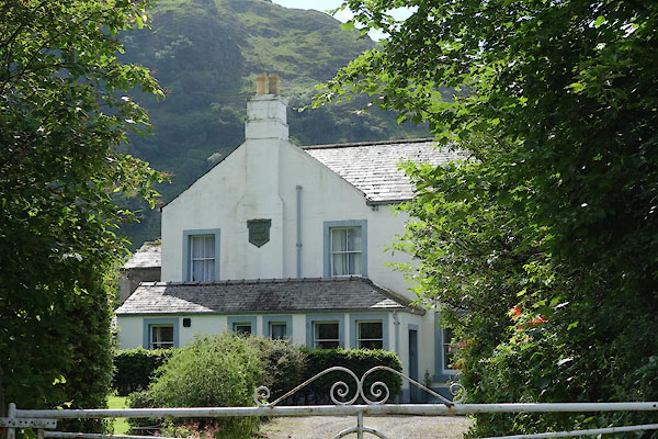 CAX98.jpg (taken 11.6.2014) 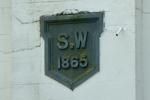 CAX99.jpg Date stone:- "S.W / 1865" (taken 11.6.2014) |
||
|
|
||
| evidence:- | old map:- OS County Series (Cmd 69 2) placename:- Rannerdale |
|
| source data:- | Maps, County Series maps of Great Britain, scales 6 and 25
inches to 1 mile, published by the Ordnance Survey, Southampton,
Hampshire, from about 1863 to 1948. |
|
|
|
||
| evidence:- | old photograph:- Bell 1880s-1940s |
|
| source data:- | Photograph, black and white, Crummock Water and Rannerdale, Buttermere, Cumberland,
by Herbert Bell, Ambleside, Westmorland, 1890s.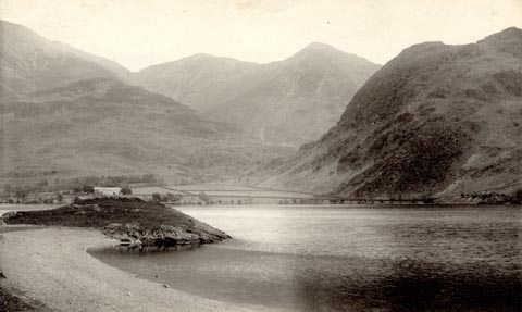 click to enlarge click to enlargeHB0466.jpg item:- Armitt Library : ALPS125 Image © see bottom of page |
|
|
|
||
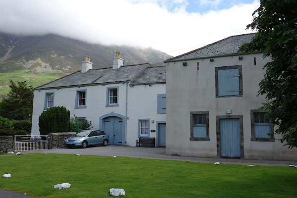 CAY01.jpg (taken 11.6.2014) 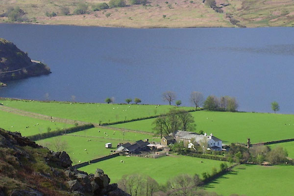 BNP62.jpg (taken 26.4.2007) |
||
|
|
||
| hearsay:- |
This is/was one of the Covenant Farms, owned by Lake District Farm Estates registered
under the Industrial Provident Societies Act 1862, set up to preserve farms. |
|
|
|
||
 Lakes Guides menu.