 Old Cumbria Gazetteer
 |
 |
|
| milestone, Warcop | ||
| site name:- | road, Brough to Appleby | |
| locality:- | Warcop | |
| civil parish:- | Warcop (formerly Westmorland) | |
| county:- | Cumbria | |
| locality type:- | milestone | |
| coordinates:- | NY75401588 | |
| 1Km square:- | NY7515 | |
| 10Km square:- | NY71 | |
|
|
||
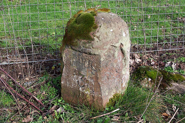 BNG28.jpg Inscribed sandstone:- "[ ROU ] 3 / [ ]E[ ]" (taken 23.2.2007) |
||
|
|
||
| evidence:- | old map:- OS County Series (Wmd 16 10) placename:- |
|
| source data:- | Maps, County Series maps of Great Britain, scales 6 and 25
inches to 1 mile, published by the Ordnance Survey, Southampton,
Hampshire, from about 1863 to 1948. "M.S. Brough ... 3 Appleby ... 5" |
|
|
|
||
 Lakes Guides menu.