 Old Cumbria Gazetteer
 |
 |
|
| milestone, Orton S | ||
| site name:- | road, Kendal to Shap | |
| civil parish:- | Orton S (formerly Westmorland) | |
| county:- | Cumbria | |
| locality type:- | milestone | |
| coordinates:- | NY55330684 | |
| 1Km square:- | NY5506 | |
| 10Km square:- | NY50 | |
|
|
||
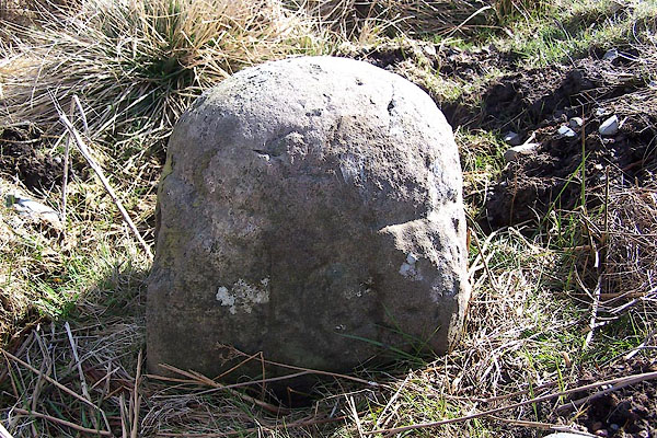 BNK24.jpg Inscribed stone:- "10" (taken 23.3.2007) |
||
|
|
||
| evidence:- | old map:- Jefferys 1770 (Wmd) |
|
| source data:- | Map, 4 sheets, The County of Westmoreland, scale 1 inch to 1
mile, surveyed 1768, and engraved and published by Thomas
Jefferys, London, 1770.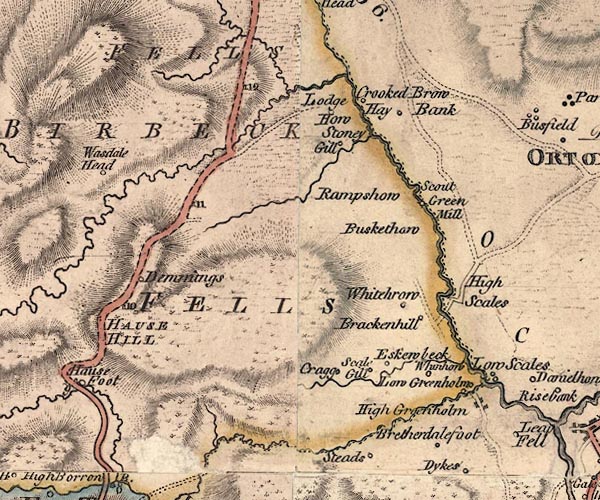 J5NY50NE.jpg "10" milestone marked by road item:- National Library of Scotland : EME.s.47 Image © National Library of Scotland |
|
|
|
||
| evidence:- | database:- Listed Buildings 2010 |
|
| source data:- | courtesy of English Heritage "MARKER STONE ON EAST SIDE OF OLD TURNPIKE ROAD TO SOUTH OF SHAP (AT NGR 553 069) / / / ORTON / EDEN / CUMBRIA / II / 74086 / NY5535506870" |
|
| source data:- | courtesy of English Heritage "Milestone or boundary stone next to old Shap/Kendal turnpike road. Early C18. Single stone, square in plan with domical top; c.l ft wide and 1 1/2 ft high. West face inscribed IO (may indicate 10 miles - to Kendal)." |
|
|
|
||
 Lakes Guides menu.