 Old Cumbria Gazetteer
 |
 |
|
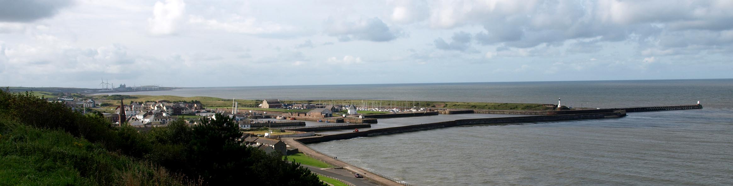
| Maryport Harbour, Maryport | ||
| Maryport Harbour | ||
| site name:- | Ellen, River | |
| locality:- | Maryport | |
| civil parish:- | Maryport (formerly Cumberland) | |
| county:- | Cumbria | |
| locality type:- | harbour | |
| coordinates:- | NY03173676 (etc) | |
| 1Km square:- | NY0336 | |
| 10Km square:- | NY03 | |
|
|
||
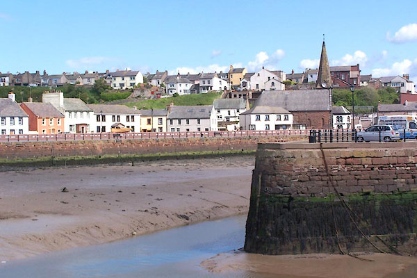 BNS23.jpg (taken 25.5.2007) 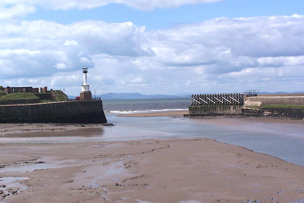 BNS24.jpg Harbour entrance. (taken 25.5.2007) |
||
|
|
||
| evidence:- | old map:- OS County Series (Cmd 44 8) placename:- Elizabeth Dock |
|
| source data:- | Maps, County Series maps of Great Britain, scales 6 and 25
inches to 1 mile, published by the Ordnance Survey, Southampton,
Hampshire, from about 1863 to 1948.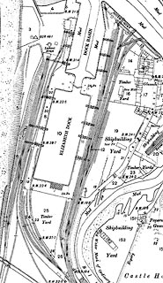 click to enlarge click to enlargeCSRY0059.jpg "Elizabeth Dock" |
|
|
|
||
| evidence:- | old map:- Donald 1774 (Cmd) |
|
| source data:- | Map, hand coloured engraving, 3x2 sheets, The County of Cumberland, scale about 1
inch to 1 mile, by Thomas Donald, engraved and published by Joseph Hodskinson, 29
Arundel Street, Strand, London, 1774.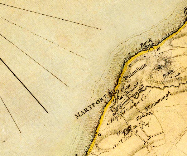 D4NY03NW.jpg mole projecting NW item:- Carlisle Library : Map 2 Image © Carlisle Library |
|
|
|
||
| evidence:- | old text:- Mackenzie 1776 placename:- Maryport Harbour placename:- Allan Foot |
|
| source data:- | Charts, and sailing directions, Nautical Descriptions of the
West Coast of Great Britain, Bristol Channel to Cape Wrath, by
Murdoch Mackenzie, published London, 1776. goto source goto sourcePage 23:- "... ..." "MARY-PORT Harbour." "In Mary-Port (formerly called Allan-foot) there are twelve feet of water, at high-water, with ordinary spring-tide, and eight with neap-tide. This place may be distinguished at sea by a glass-house on the Point near the W. end of the town." page 24 "Time of High-water. / It is high-water here on full and change days at 11½." |
|
|
|
||
| evidence:- | old map:- Walker 1842 |
|
| source data:- | Chart, Position of all the Lighthouses in the British Isles,
scale about 38 nautical miles to 1 inch, published by J and A
Walker, 72 South Castle Street, Liverpool, Lancashire, 1842. Marked with a harbour light "Maryport - Two Steady Lights Shewn whilst 8 feet depth is in the Harbour" |
|
|
|
||
| evidence:- | old text:- Admiralty 1933 placename:- item:- pilot, Maryport Harbour; dredger; navigation lights; coal; water; cranes; shipping; railways; storm signal |
|
| source data:- | goto source Page 387:- "..." "FIRTH OF SOLWAY. - ..." "Whitehaven, Workington, Maryport and Silloth, all on the English shore, are the chief trading ports in the firth." goto sourcePage 388:- "..." "Pilots. - There are Trinity House pilots for Whitehaven, Workington, and Maryport, the pilot cutter, which does not cruise, being stationed at Whitehaven; vessels requiring pilots for any of these places can obtain them off Whitehaven, or may proceed to a point off their destination." "The signal to be made during foggy weather by a vessel requiring a pilot is three long blasts; the reply is one long and two short blasts." goto sourcePage 396:- "..." "... Maryport harbour is situated at the mouth of the River Ellen, and consists of a tidal harbour, of about 15 acres in extent, and two wet docks, about 6 acres and 3 1/4 in extent, respectively. It is contained within North pier, which projects westward, for a distance of about 1,200 feet (365m8), from the north-eastern point of the entrance to the River Ellen, to a position about 160 feet (48m8) northward of the southern point of the entrance. A wooden breakwater, named South pier, projects about 600 feet (182m9) westward from the southern point of the entrance, and protects the entrance." "The harbour dries out for some distance beyond South pier, but depths of about 24 feet (7m3), at high water springs, are maintained, by dredging, in the entrance channel and through Senhouse basin." "The tidal harbour is divided into Senhouse basin, situated on the southern side of the harbour immediately within the entrance; Elizabeth basin, situated eastward of Senhouse basin being separated from it by South jetty; Old harbour formed by the mouth of the River Ellen between South and North quays; and North harbour, which lies between Tongue pier, the extension westward of North quay, and the inner part of North pier." "Senhouse basin provides 500 feet (152m4) of quayage, with depths of from 20 to 24 feet (6m1 to 7m3) alongside at high water springs; Elizabeth basin, 1,050 feet (320m0), with depths of about 22 feet (6m7) alongside at high water springs; Old harbour, 1,300 feet (396m2), with depths of about 12 feet (3m7) alongside at high water springs; and North harbour, 700 feet (213m4), with depths of 8 feet (2m4) alongside at high water springs. Old and North harbours are now seldom used." "The channel of the River Ellen is crossed, above Old harbour, by a swing bridge with an opening 46 feet (14m0) wide." "Wet docks. - Senhouse dock is situated southward of Senhouse basin (Lat. 54~ 43' N., Long. 3~ 30' W.). It is entered from that basin through a passage with a gateway, 50 feet (15m2) wide, the sill of which just dries. It provides 2,200 feet (670m6) of quayage, with depths of 24 feet (7m3) alongside at high water springs; depths of 15 feet (4m6) are normally maintained in Senhouse dock." "Elizabeth dock is situated southward of Elizabeth basin. It is entered from that basin through a passage with a gateway, 50 feet (15m2) wide, the sill of which dries 5 feet (1m5). It provides 1,600 feet (487m7) of quayage, with depths of from 20 to 21 feet (6m1 to 6m4) alongside at high water springs.; depths of 12 feet (3m7) are normally maintained in Elizabeth dock." "The gates of both docks are usually open from about 1 1/2 hours before until one hour after high water." "Lights. - Signals. - A light is exhibited, at an elevation of 32 feet (9m8), from a white mast, 22 feet (6m7) in height, situated at the head of South pier" |
|
| source data:- | goto source Page 397:- "A light is exhibited, at an elevation of 32 feet (9m8), from a white column, 20 feet (6m1) in height, situated at the head of North pier." "A red ball is displayed from a flagstaff at the root of South pier, by day, or a white light is exhibited, at an elevation of 52 feet (15m9), from a white octagonal tower, 42 feet (12m8) in height, situated a short distance southward of the flagstaff, at night, when there are depths of 8 feet (2m4) or more in the harbour." "During tidal hours, namely from 2 1/2 hours before until 1 1/2 hours after high water, a green light is exhibited, at an elevation of 30 feet (9m1), from a white mast, 25 feet (7m6) in height, situated on the head of South jetty." "During the same period, a red light is exhibited, at an elevation of 25 feet (7m6), from a mast, 20 feet (6m1) in height, situated at the head of Tongue pier." "Two red balls displayed from the flagstaff at the root of South pier, by day, or a red light exhibited 12 feet (3m7) below the above-mentioned white light, at night, denote that the channel is obstructed." "Dredgers, when working in the entrance channel or harbour, will show the following signals: A red flag, by day, or a red light at the same height as the riding light, at night, on the side on which the obstruction exists." "Pilotage. - Tug. - Pilotage is compulsory for all foreign-going merchant vessels." "For information regarding pilots see page 388." "A tug is available when dredging is in progress; vessels requiring its services display a Union Jack at the main, by day, or two lights, vertically disposed, at night." "Directions. - The time for entering Maryport (Lat. 54~ 43' N., Long. 3~ 30' W.) is from 2 hours before until 1 hour after high water." "When entering, pass along South pier at a distance of about 30 feet (9m1) from it and from thence to the docks or inner harbour as requisite." "From the end of the North pier, a large linked chain extends seaward, parallel with the wooden pier, for the purpose of catching the anchors of sailing vessels which have missed the harbour, to prevent them drifting on to the North beach." "Port facilities. - Coal from local collieries may be obtained in any quantity. Vessels are supplied with coal alongside by tips and a conveyor; by means of the former, they can be coaled at the rate of 200, and by the latter, at 400 tons an hour. There are no facilities for coaling at anchor." "Water is laid on at the quays, but there are no tanks for supplying vessels at anchor." "Repairs to engines and boilers are undertaken by local firms." "Senhouse dock is equipped with six travelling steam cranes, with lifting power up to 8 tons, grabs, and other appliances for the rapid discharge and loading of vessels." "Elizabeth dock is equipped with one 3-ton travelling steam crane." "All quays and docks are connected by rail to the mainline railway system, and the tramways of the local ironworks." "The Victoria cottage hospital has 14 beds and the isolation hospital 4 beds." |
|
| source data:- | goto source Page 398:- "Shipping. - Trade. - During the year 1932, three vessels, with an aggregate tonnage of 2,181 tons, entered the port from foreign and colonial ports; and 461 vessels, with an aggregate tonnage of 46,332 tons, coastwise. The largest vessel that has entered the port, up to 1933, is one of 6,500 tons." "Since the opening of the deep-water dock at Workington, in 1927, the trade of Maryport has declined, and now consist principally of shipment of coal from collieries northward of the port. During the years of 1929, 1930, and 1931, the average total of the imports, which consisted chiefly of petroleum spirit, oxide and cement, amounted to 8,000 tons per annum. During the same period the average of the exports, which consisted chiefly of coal, coke, creosote, tar, and pitch, amounted to 140,000 tons per annum." "Life-saving. - A motor lifeboat is stationed at Maryport (Lat. 54~ 43' N., Long. 3~ 30' W.)." "Storm signals. - Storm signals are displayed from a signal mast situated on the embankment near the root of South pier." |
|
|
|
||
| evidence:- | old print:- item:- |
|
| source data:- | Print, halftone photograph, Sunset, Pier Head, Maryport, by Valentine and Sons, published
by Cumberland Motor Services, Tangier Street, Whitehaven, Cumberland, about 1926.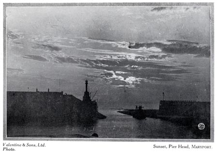 click to enlarge click to enlargeCS102.jpg On p.15 of Cumberland its Lakes and Mountains. lower right "WP" printed, bottom, left right "Valentine &Sons, Ltd. Photo. / Sunset, Pier Head, Maryport." item:- JandMN : 1022.2 Image © see bottom of page |
|
|
|
||
 old shipping directory old shipping directory |
||
|
|
||
| evidence:- | old painting:- item:- ship |
|
| source data:- | Painting, oil painting, Maryport, Cumberland, by William Mitchell, 1870s.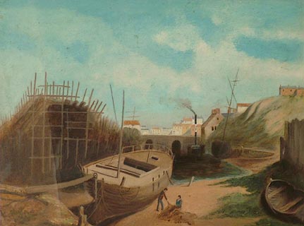 click to enlarge click to enlargePR1039.jpg In the foreground a large boat lies in dry dock, two fishermen beside it tending to their nets. To left of composition stands a substantial wooden construction. Beyond, other boats lie moored beside the shoreline. The town stands in the background in centre of composition, above a stone harbour wall. item:- Tullie House Museum : 1970.33.21 Image © Tullie House Museum |
|
|
|
||
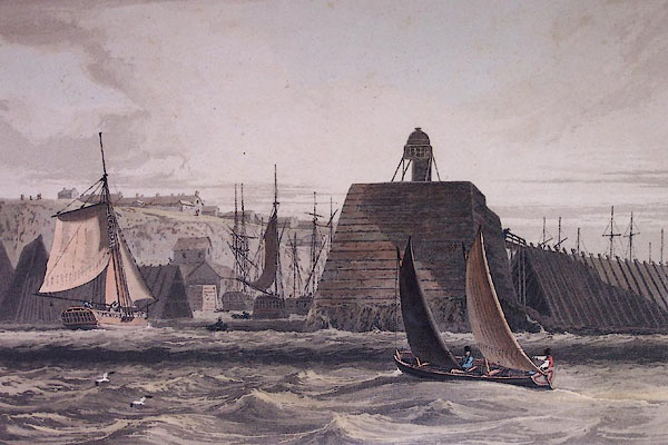
| evidence:- | old print:- placename:- Mary Port Pier |
|
| source data:- | Print, uncoloured engraving, Mary-Port Pier, Maryport, Cumberland, drawn by W H Bartlett,
engraved by J Cousen, published 1840s.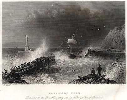 click to enlarge click to enlargePR0074.jpg Probably from Findens Views of the Ports, Harbours, Coast Scenery, and Watering Places of Great Britain, as continued by W H Bartlett. printed at bottom left, right, centre:- "W. H. Bartlett. / J. Cousen. / MARY-PORT PIER. / Dedicated to the Rev. Humphrey Archer Hervey, Vicar of Bridekirk." item:- Dove Cottage : 2008.107.74 Image © see bottom of page |
|
|
|
||
| evidence:- | old print:- |
|
| source data:- | Print, uncoloured engraving, Maryport, Cumberland, drawn by W H Bartlett, engraved
by J C Armytage, published 1840s.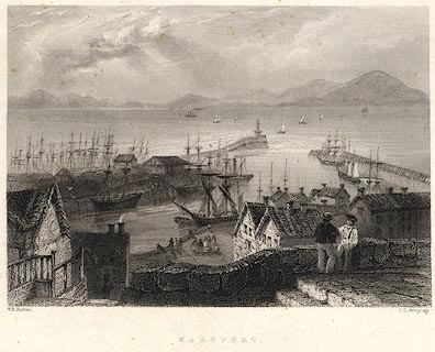 click to enlarge click to enlargePR0075.jpg Probably from Findens Views of the Ports, Harbours, Coast Scenery, and Watering Places of Great Britain, as continued by W H Bartlett. printed at bottom left, right, centre:- "W. H. Bartlett. / J. C. Armytage. / MARYPORT." item:- Dove Cottage : 2008.107.75 Image © see bottom of page |
|
|
|
||
 Click to enlarge BRI74.jpg (taken 2.9.2009) 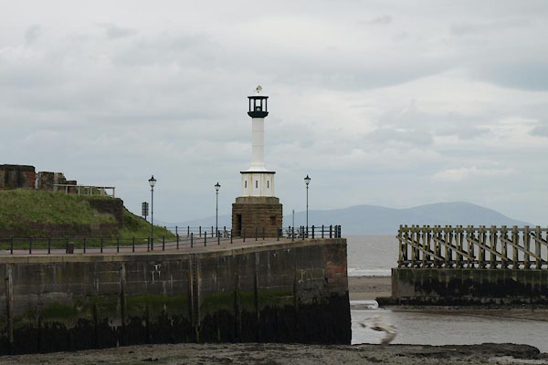 BUQ23.jpg Harbour entrance. (taken 27.5.2011) |
||
|
|
||
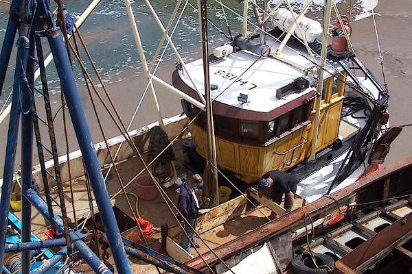 BNS21.jpg Trawler (taken 25.5.2007) 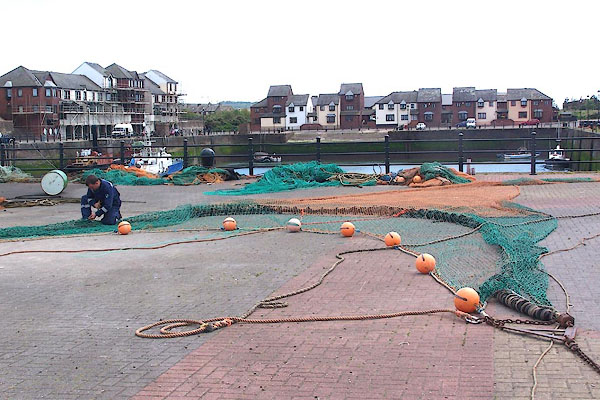 BNS16.jpg Trawl net, being mended. (taken 25.5.2007) 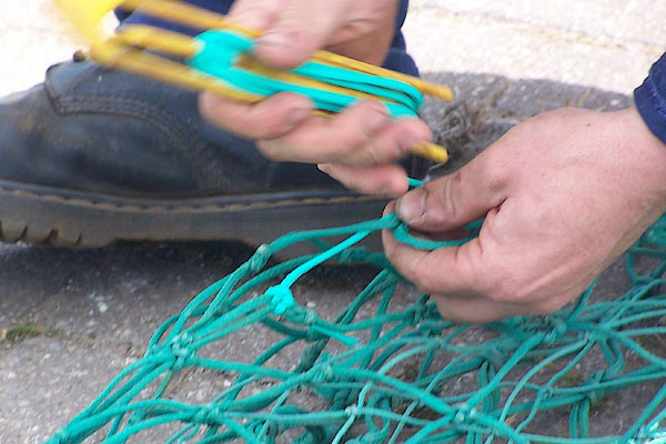 BNS17.jpg Mending a net. (taken 25.5.2007) 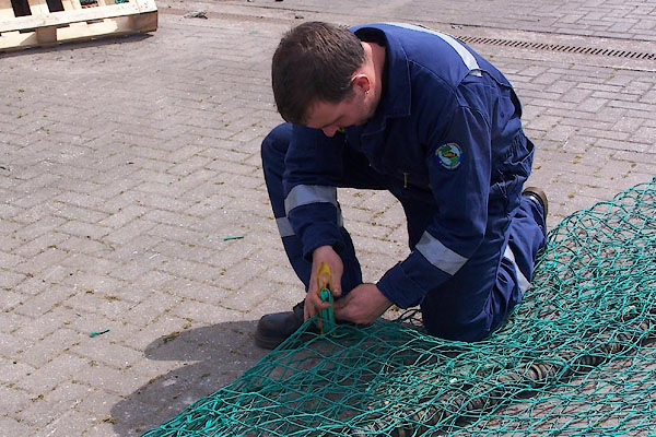 BNS18.jpg Mending a net. (taken 25.5.2007) 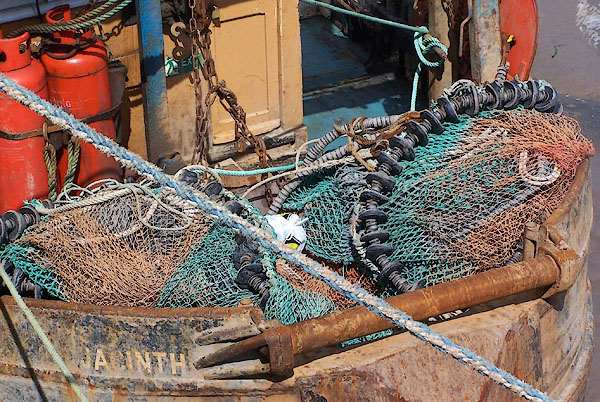 BNS20.jpg Nets on the stern of trawler Jacinth. (taken 25.5.2007) |
||
|
|
||
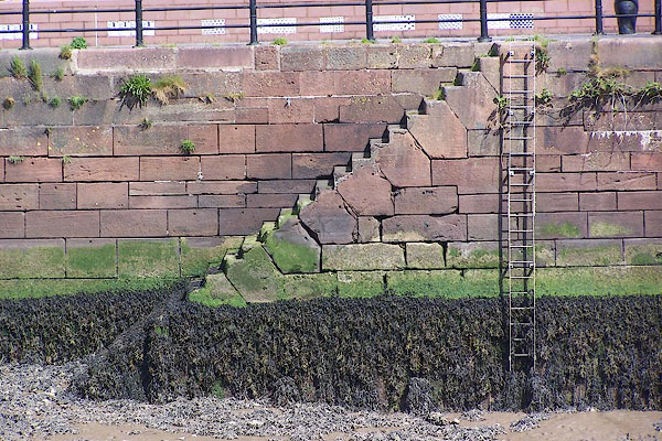 BNS29.jpg Steps in sandstone, North Quay. (taken 25.5.2007) 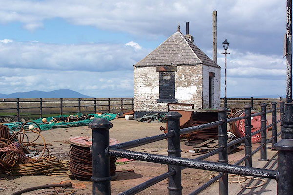 BNS22.jpg One of the harbour buildings. (taken 25.5.2007) 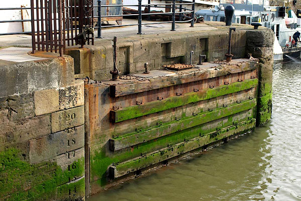 BOU67.jpg Dock gate, and depth gauge. (taken 14.3.2008)  BNS26.jpg Bollard. (taken 25.5.2007) 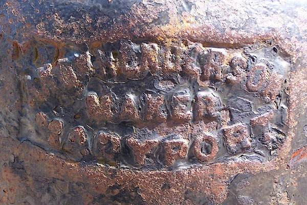 BNS27.jpg Bollard:- "[AN HENDERSON / MAKER / MARYPORT]" (taken 25.5.2007) 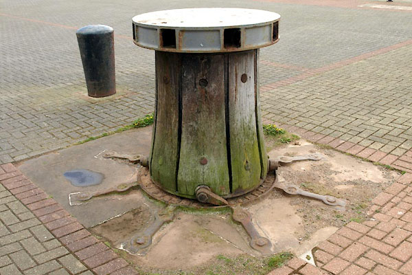 BWI26.jpg Capstan, (taken 4.5.2012) 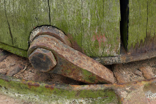 BWI27.jpg Capstan, (taken 4.5.2012) 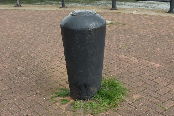 BWI31.jpg Bollard, (taken 4.5.2012) 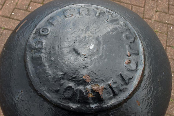 BWI32.jpg Bollard, "[ DOHERTY / CONTRACTOR]" (taken 4.5.2012) 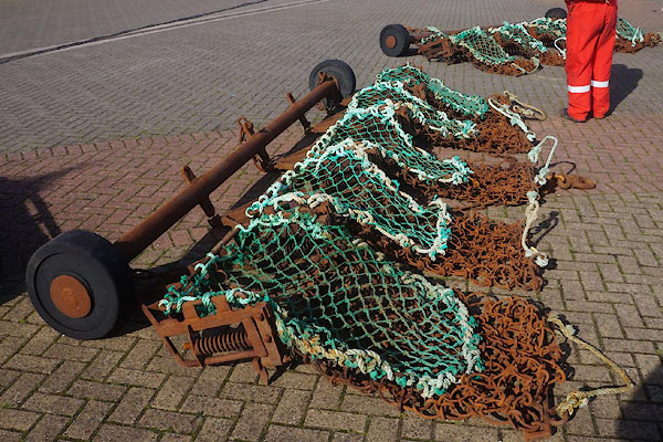 CFN99.jpg Scallop nets. (taken 30.9.2016) |
||
|
|
||
 BNS41.jpg (taken 25.5.2007) |
||
|
|
||
| hearsay:- |
The North Quay was built by Humphry Senhouse, 1749, who named the new town after his
wife Mary. |
|
| The elegant lighthouse on the quay was built 1846. It was the first cast iron lighthouse
in England. |
||
| Elizabeth Dock was built 1857; Senhouse Dock was built by W J Doherty for Sir John
Hawkshaw and Harrison Hayter, 1881-84. |
||
|
|
||
Lakes Guides menu.