 Old Cumbria Gazetteer
 |
 |
|
| included in:- |
 limekilns, Coniston Limestone Series limekilns, Coniston Limestone Series |
|
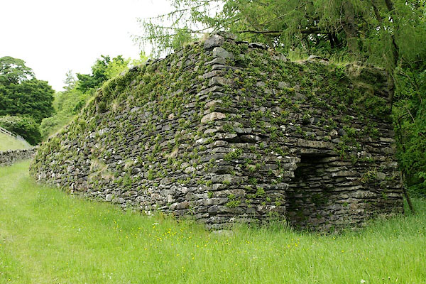
| limekiln, Stockdale (2) | ||
| site name:- | Stockdale | |
| civil parish:- | Longsleddale (formerly Westmorland) | |
| county:- | Cumbria | |
| locality type:- | limekiln | |
| locality type:- | Coniston limestone series | |
| locality type:- | kiln | |
| locality type:- | geological site | |
| coordinates:- | NY49140542 | |
| 1Km square:- | NY4905 | |
| 10Km square:- | NY40 | |
| stratigraphy:- | Coniston Limestone Series | |
|
|
||
 BQT36.jpg (taken 9.6.2009) 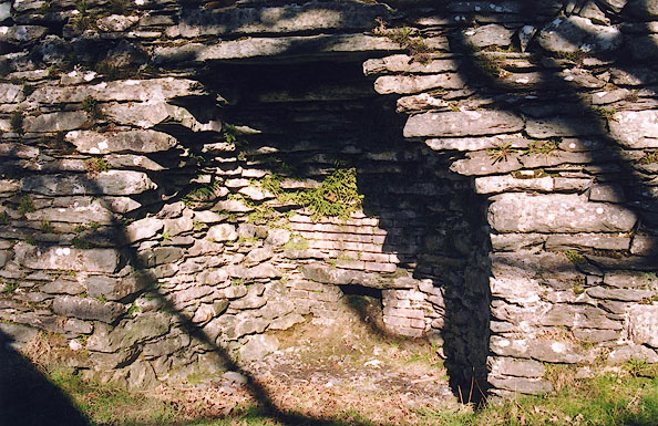 BIL13.jpg (taken 26.2.2004) |
||
|
|
||
| evidence:- | old map:- OS County Series (Wmd 27 7) |
|
| source data:- | Maps, County Series maps of Great Britain, scales 6 and 25
inches to 1 mile, published by the Ordnance Survey, Southampton,
Hampshire, from about 1863 to 1948. "Old Limekiln" And a quarry immediately to the east. 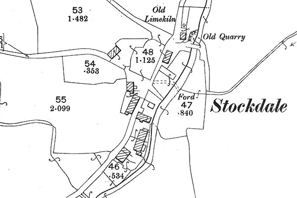 BII52.jpg |
|
|
|
||
| evidence:- | map:- OS Six Inch (1956) |
|
| source data:- | Map series, various editions with the national grid, scale about
6 inches to 1 mile, published by the Ordnance Survey,
Southampton, Hampshire, scale 1 to 10560 from 1950s to 1960s,
then 1 to 10000 from 1960s to 2000s, superseded by print on
demand from digital data.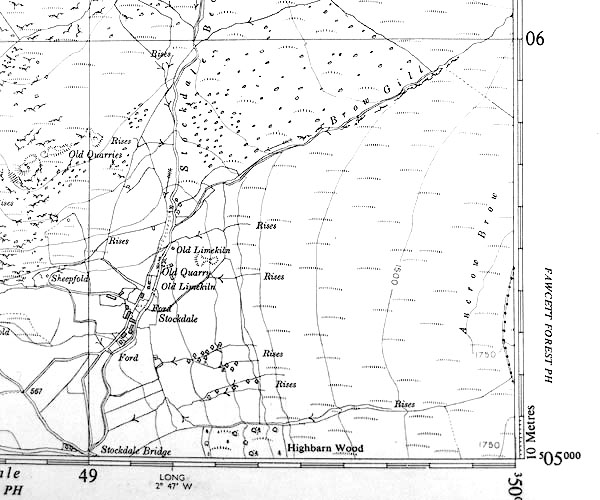 SINY4905.jpg "Old Limekiln" |
|
|
|
||
| notes:- |
18th century kiln, using limestone from the Coniston Limestone Series which runs across
Longsleddale about Tills Hole and Stockdlae. |
|
| Hopkins, Tony &Corbett, Val: 2008 (?): Lime Kilns in the Lake District: Lake Distrist
National Park Authority (Kendal, Cumbria) |
||
|
|
||
| : 2009: Archaeology Data Service &ADS |
||
|
|
||
Lakes Guides menu.