 Old Cumbria Gazetteer
 |
 |
|
| Kirkstonefoot, Patterdale | ||
| Kirkstonefoot | ||
| site name:- | road, Kirkstone to Patterdale | |
| civil parish:- | Patterdale (formerly Westmorland) | |
| county:- | Cumbria | |
| locality type:- | locality | |
| coordinates:- | NY40361186 | |
| 1Km square:- | NY4011 | |
| 10Km square:- | NY41 | |
|
|
||
| evidence:- | old map:- OS County Series (Wmd 19 7) placename:- Kirkstonefoot |
|
| source data:- | Maps, County Series maps of Great Britain, scales 6 and 25
inches to 1 mile, published by the Ordnance Survey, Southampton,
Hampshire, from about 1863 to 1948. |
|
|
|
||
| evidence:- | old map:- Jefferys 1770 (Wmd) placename:- Kirkstone Foot |
|
| source data:- | Map, 4 sheets, The County of Westmoreland, scale 1 inch to 1
mile, surveyed 1768, and engraved and published by Thomas
Jefferys, London, 1770.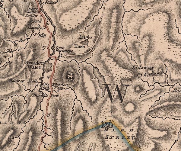 J5NY41SW.jpg "Kirkstone Foot" circle, labelled in italic lowercase text; settlement, farm, house, or hamlet? item:- National Library of Scotland : EME.s.47 Image © National Library of Scotland |
|
|
|
||
| evidence:- | perhaps old map:- Garnett 1850s-60s H placename:- Hartsop |
|
| source data:- | Map of the English Lakes, in Cumberland, Westmorland and
Lancashire, scale about 3.5 miles to 1 inch, published by John
Garnett, Windermere, Westmorland, 1850s-60s.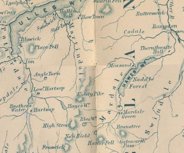 GAR2NY41.jpg "Hartsop" block, building item:- JandMN : 82.1 Image © see bottom of page |
|
|
|
||
| evidence:- | old print:- Rose 1832-35 placename:- Kirkstone Foot item:- sheep |
|
| source data:- | Print, engraving, Brother's Water from Kirkstone Foot, Westmorland, by Thomas Allom,
engraved by R Sands, 1834.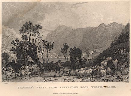 click to enlarge click to enlargeR233.jpg "BROTHER'S WATER FROM KIRKSTONE FOOT, WESTMORLAND." item:- JandMN : 66.44 Image © see bottom of page |
|
|
|
||
 Lakes Guides menu.