 Old Cumbria Gazetteer
 |
 |
|
| Katebarrow, Whitwell and Selside | ||
| Katebarrow | ||
| Catbarrow | ||
| civil parish:- | Whitwell and Selside (formerly Westmorland) | |
| county:- | Westmorland | |
| locality type:- | building/s (? disused) | |
| locality type:- | barn (? disused) | |
| coordinates:- | SD52039989 | |
| 1Km square:- | SD5299 | |
| 10Km square:- | SD59 | |
|
|
||
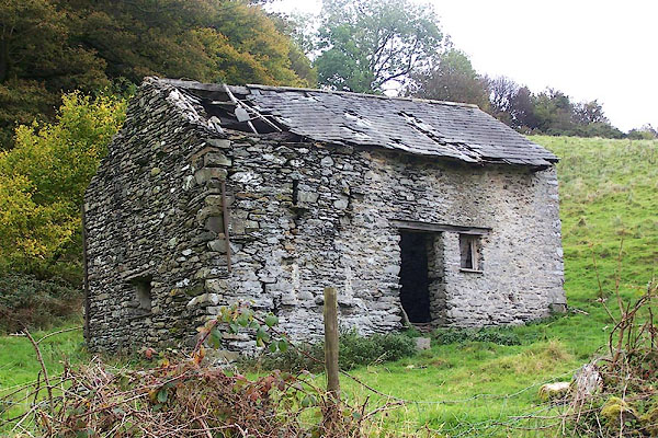 BOG83.jpg (taken 13.10.2007) 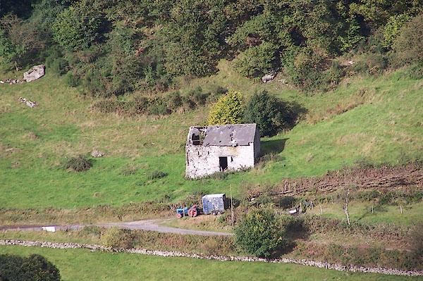 BJX04.jpg (taken 1.10.2005) |
||
|
|
||
| evidence:- | old map:- OS County Series (Wmd 33 4) placename:- Katebarrow |
|
| source data:- | County Series map, Westmorland sheet 33 4, part of Longsleddale, Westmorland, scale
25 inches to 1 mile, published by the Ordnance Survey, Southampton, Hampshire, about
1890s?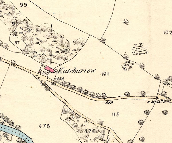 BNJ82.jpg item:- private collection : 55 Image © see bottom of page |
|
|
|
||
| evidence:- | old map:- OS County Series (Wmd 33 4) placename:- Katebarrow |
|
| source data:- | Maps, County Series maps of Great Britain, scales 6 and 25
inches to 1 mile, published by the Ordnance Survey, Southampton,
Hampshire, from about 1863 to 1948. County Series 25 inch map, Westmorland sheet XXXIII 4, surveyed 1858-59, revised 1896, 2nd edition published by Ordnance Survey, 1898. "Katebarrow" |
|
|
|
||
| evidence:- | old map:- Jefferys 1770 (Wmd) placename:- Coat Barrow |
|
| source data:- | Map, 4 sheets, The County of Westmoreland, scale 1 inch to 1
mile, surveyed 1768, and engraved and published by Thomas
Jefferys, London, 1770.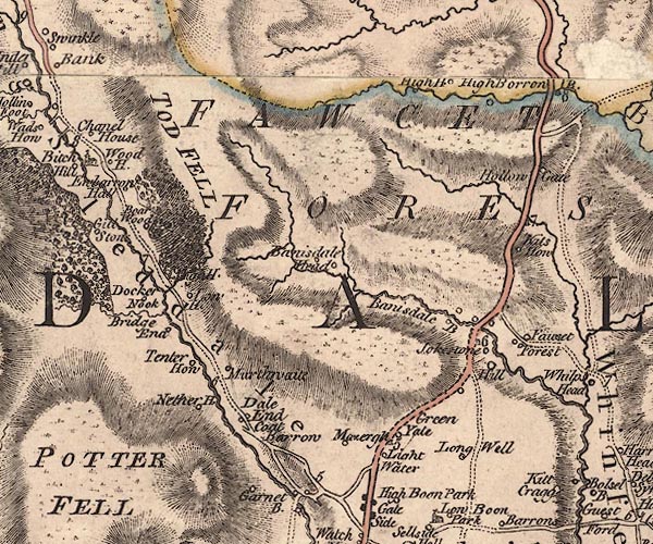 J5NY50SW.jpg "Coat Barrow" circle, labelled in italic lowercase text; settlement, farm, house, or hamlet? item:- National Library of Scotland : EME.s.47 Image © National Library of Scotland |
|
|
|
||
| evidence:- | old map:- Hodgson 1828 placename:- Catbarrow |
|
| source data:- | Map, hand coloured engraving, 4 sheets mounted together on linen and rolled, Plan
of the County of Westmorland, scale about 1.25 inches to 1 mile, by Thomas Hodgson,
engraved by W R Gardner, Harpur Street, London, published by Thomas Hodgson, Lancaster,
and perhaps by C Smith, 172 Strand, London,1828.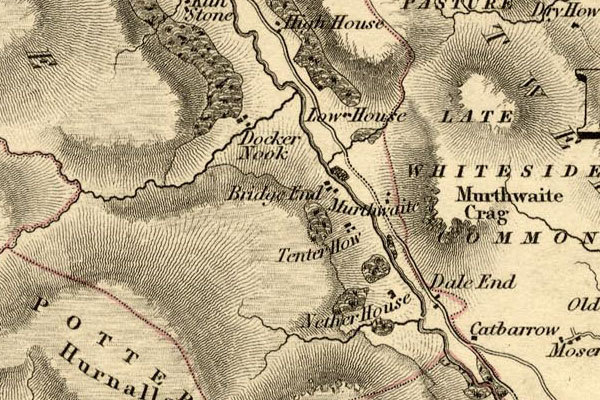 HDG6lsl1.jpg map courtesy of Mark Cropper "Catbarrow" item:- private collection : 371 Image © see bottom of page |
|
|
|
||
| evidence:- | parish register:- KendalRO : WPR/85 placename:- Catbarrow |
|
| source data:- | Miles Swainson son of John Swainson, baptized 14 April 1672 |
|
|
|
||
| evidence:- | parish
register:- KendalRO : WPR/85 placename:- Calbarrow |
|
| source data:- | John Airey, calbarrow, buried 16 September 1748. |
|
|
|
||
| evidence:- | map:- OS Six Inch (1956) placename:- Katebarrow |
|
| source data:- | Map series, various editions with the national grid, scale about
6 inches to 1 mile, published by the Ordnance Survey,
Southampton, Hampshire, scale 1 to 10560 from 1950s to 1960s,
then 1 to 10000 from 1960s to 2000s, superseded by print on
demand from digital data.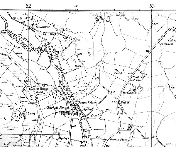 SISD5299.jpg "Katebarrow" |
|
|
|
||
| evidence:- | old newspaper:- Z8900705.txt placename:- Catbarrow item:- placename, Katebarrow; cat |
|
| source data:- | Z8900705.txt Westmorland Gazette Transcription from the Westmorland Gazette 5 July 1890 page 6:- "... Catbarrow, the haunt of the wild cats, and these have passed away, and their place is supplied by the domestic cats, which run to the fells after rabbits, and soon become wild, or else are shot and otherwise destroyed by game preservers. ..." |
|
|
|
||
| hearsay:- |
It is said that some while back, planning permission to restore this barn as a small
domestic residence or holiday let was refused by the Lakes District National Park.
They would prefer to see it gradually fall down, fulfilling it natural role ... |
|
|
|
||
 Lakes Guides menu.