 |
 |
   |
|
|
|
Gudham Gill Mines |
| locality:- |
Nenthead |
| civil parish:- |
Alston Moor (formerly Cumberland) |
| county:- |
Cumbria |
| locality type:- |
lead mine |
| locality type:- |
mine |
| coordinates:- |
NY78404510 |
| 1Km square:- |
NY7845 |
| 10Km square:- |
NY74 |
| references:- |
KDMRS 1979-82
|
|
|
| evidence:- |
possibly old map:- Donald 1774 (Cmd)
|
| source data:- |
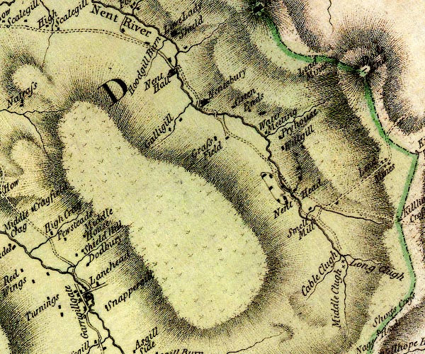
Map, hand coloured engraving, 3x2 sheets, The County of Cumberland, scale about 1
inch to 1 mile, by Thomas Donald, engraved and published by Joseph Hodskinson, 29
Arundel Street, Strand, London, 1774.

D4NY74SE.jpg
"Lead Mines"
no symbol
item:- Carlisle Library : Map 2
Image © Carlisle Library |
|
|
| evidence:- |
visit log:- KDMRS 1979-82
placename:- Gudham Gill Mines
item:- blende; galena
|
| source data:- |
Notes, log book of Geological Outings, mine plans, etc, Kendal
and District Mine Research Society, Kendal area, Cumbria, etc,
visits made 1979-82.
Geological Outing of the Kendal and District Mine Research Society
Log book page 34:- "DATE - 30/9/79 SUNDAY / MAP REF - 7840/4510 / LOCATION - GUDHAM GILL / NAME - GUDHAM
GILL MINES / TYPE OF SITE - MINES / WORKING OR DISUSED - DISUSED / PEOPLE IN PARTY
[ ] / NOS. OF PHOTOS - 22 / SPECIMENS FOUND - BLENDE &GALENA / COMMENTS - COOL DRY
DAY. SPOIL HEAPS OVER A WIDE AREA. NO LEVELS LEFT OPEN TO ENTER. ONLY LEVEL LEFT WAS
BLOCKED BY ROOF FALLS. INTERESTING DAY."
item:- private collection : 82
Image © see bottom of page
|
|
|


 Lakes Guides menu.