 Old Cumbria Gazetteer
 |
 |
|
| Green Yew, Winster | ||
| Green Yew | ||
| locality:- | Winster | |
| civil parish:- | Crook (formerly Westmorland) | |
| county:- | Cumbria | |
| locality type:- | buildings | |
| coordinates:- | SD41799332 | |
| 1Km square:- | SD4193 | |
| 10Km square:- | SD49 | |
|
|
||
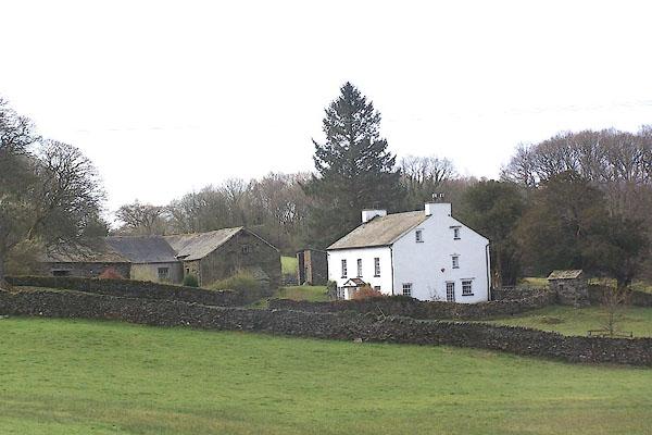 BNM98.jpg (taken 5.4.2007) 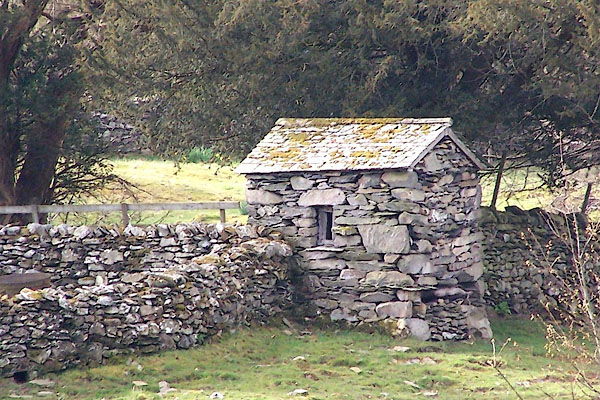 BNM99.jpg A privy at the bottom of the garden? (taken 5.4.2007) |
||
|
|
||
| evidence:- | old map:- OS County Series (Wmd 37 4) placename:- Green Yew |
|
| source data:- | Maps, County Series maps of Great Britain, scales 6 and 25
inches to 1 mile, published by the Ordnance Survey, Southampton,
Hampshire, from about 1863 to 1948. |
|
|
|
||
 Lakes Guides menu.