 Old Cumbria Gazetteer
 |
 |
|
| chapel, Sandford | ||
| locality:- | Sandford | |
| civil parish:- | Warcop (formerly Westmorland) | |
| county:- | Cumbria | |
| locality type:- | chapel | |
| locality type:- | methodist chapel | |
| coordinates:- | NY72961618 | |
| 1Km square:- | NY7216 | |
| 10Km square:- | NY71 | |
|
|
||
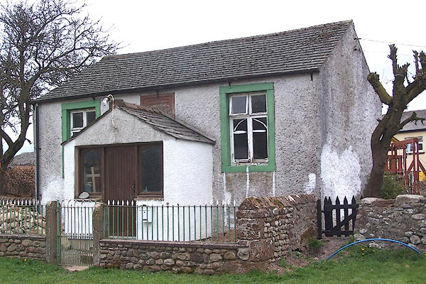 BNN58.jpg (taken 10.4.2007) 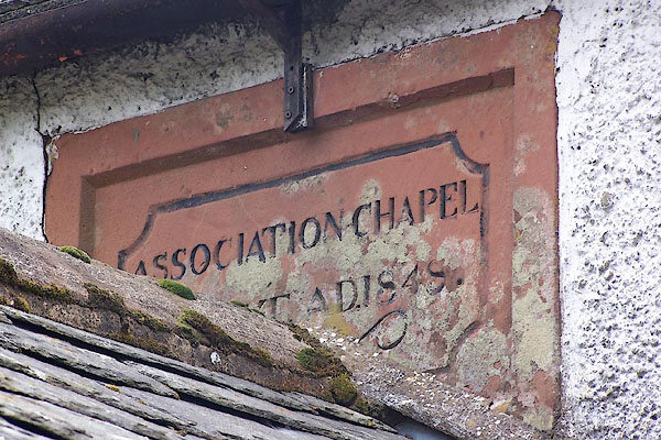 BNN59.jpg Plaque:- "ASSOCIATION CHAPEL / BUILT A.D. 1848." (taken 10.4.2007) |
||
|
|
||
| evidence:- | old map:- OS County Series (Wmd 16 9) |
|
| source data:- | Maps, County Series maps of Great Britain, scales 6 and 25
inches to 1 mile, published by the Ordnance Survey, Southampton,
Hampshire, from about 1863 to 1948. "Methodist Chapel (Association)" |
|
|
|
||
 Lakes Guides menu.