 Old Cumbria Gazetteer
 |
 |
|
| bridge, Waterhouses | ||
| site name:- | Waterhouses Beck | |
| locality:- | Water Houses | |
| civil parish:- | Asby (formerly Westmorland) | |
| civil parish:- | Soulby (formerly Westmorland) | |
| county:- | Cumbria | |
| locality type:- | bridge | |
| locality type:- | boundary stone | |
| locality type:- | parish boundary mark | |
| coordinates:- | NY71271090 | |
| 1Km square:- | NY7110 | |
| 10Km square:- | NY71 | |
|
|
||
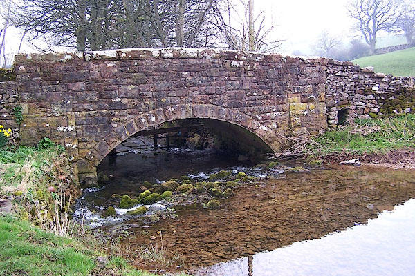 BNL76.jpg (taken 30.3.2007) 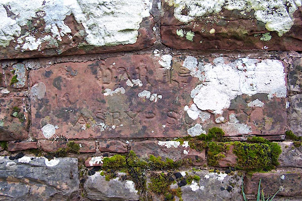 BNL77.jpg Boundary stone on northern parapet:- "PARIS[H] / 18 75 / ASBY S[O LB]Y" (taken 30.3.2007) |
||
|
|
||
| evidence:- | old map:- Jefferys 1770 (Wmd) |
|
| source data:- | Map, 4 sheets, The County of Westmoreland, scale 1 inch to 1
mile, surveyed 1768, and engraved and published by Thomas
Jefferys, London, 1770.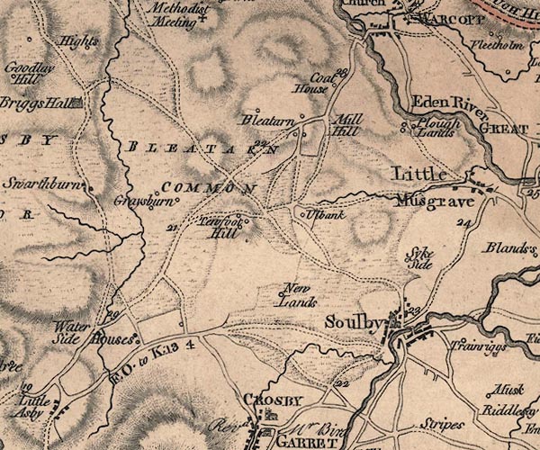 J5NY71SW.jpg double line, road, across a stream; bridge item:- National Library of Scotland : EME.s.47 Image © National Library of Scotland |
|
|
|
||
| evidence:- | database:- Listed Buildings 2010 |
|
| source data:- | courtesy of English Heritage "ROADBRIDGE OVER POTTS BECK AT WATER HOUSES / / / ASBY / EDEN / CUMBRIA / II / 73261 / NY7127510902" |
|
| source data:- | courtesy of English Heritage "Roadbridge incorporating Parish boundary stone date 1875. Single span with segmental arch. Squared, snecked rubble with roughly-dressed blocks to parapet. Stone to inner north wall has "PARISH" in Gothic lettering with split date and "ASBY-SOULBY" in Roman lettering below." |
|
|
|
||
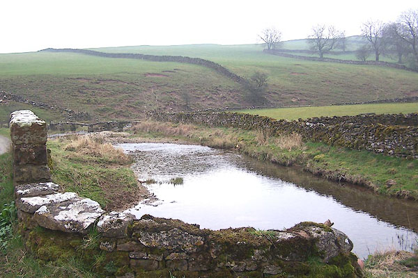 BNL78.jpg View of river. (taken 30.3.2007) |
||
|
|
||
 Lakes Guides menu.