 Old Cumbria Gazetteer
 |
 |
|
| bridge, Toms Howe | ||
| site name:- | Sprint, River | |
| civil parish:- | Longsleddale (formerly Westmorland) | |
| county:- | Cumbria | |
| locality type:- | bridge | |
| coordinates:- | NY48950477 | |
| 1Km square:- | NY4804 | |
| 10Km square:- | NY40 | |
|
|
||
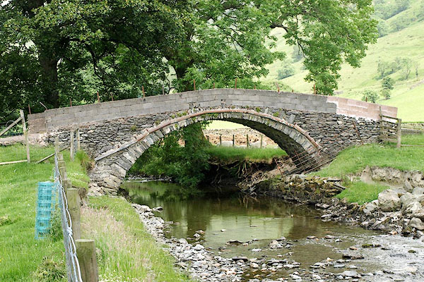 BQX72.jpg (taken 28.6.2009) 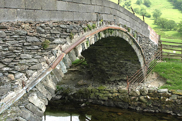 BQX74.jpg (taken 28.6.2009) |
||
|
|
||
| evidence:- | map:- OS Six Inch (1956) |
|
| source data:- | Map series, various editions with the national grid, scale about
6 inches to 1 mile, published by the Ordnance Survey,
Southampton, Hampshire, scale 1 to 10560 from 1950s to 1960s,
then 1 to 10000 from 1960s to 2000s, superseded by print on
demand from digital data.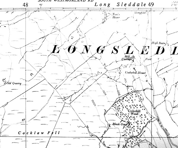 SINY4804.jpg track to Toms Howe |
|
|
|
||
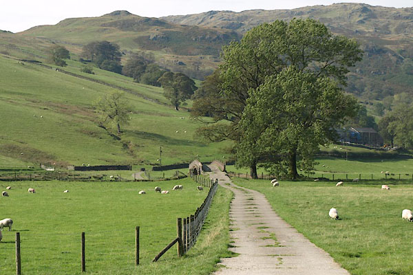 BVK65.jpg (taken 30.9.2011) |
||
|
|
||
 Lakes Guides menu.