 Old Cumbria Gazetteer
 |
 |
|
| bridge, Docker Nook | ||
| site name:- | Sprint, River | |
| locality:- | Longsleddale | |
| civil parish:- | Longsleddale (formerly Westmorland) | |
| county:- | Cumbria | |
| locality type:- | bridge | |
| coordinates:- | NY50870148 | |
| 1Km square:- | NY5001 | |
| 10Km square:- | NY50 | |
| SummaryText:- | Carrying the track to Docker Nook from the road, over the River Sprint. | |
|
|
||
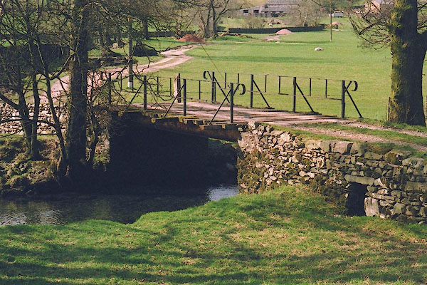 BIO15.jpg (taken 30.3.2004) |
||
|
|
||
| evidence:- | old map:- OS County Series (Wmd 27 16) |
|
| source data:- | Maps, County Series maps of Great Britain, scales 6 and 25
inches to 1 mile, published by the Ordnance Survey, Southampton,
Hampshire, from about 1863 to 1948. |
|
|
|
||
| evidence:- | map:- OS Six Inch (1956) |
|
| source data:- | Map series, various editions with the national grid, scale about
6 inches to 1 mile, published by the Ordnance Survey,
Southampton, Hampshire, scale 1 to 10560 from 1950s to 1960s,
then 1 to 10000 from 1960s to 2000s, superseded by print on
demand from digital data.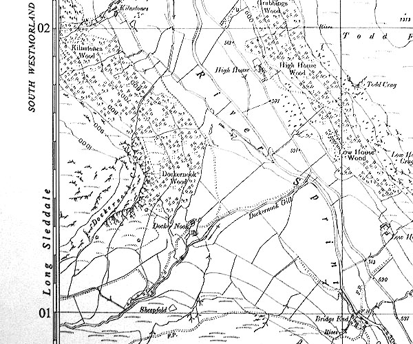 SINY5001.jpg track to Docker Nook |
|
|
|
||
 Lakes Guides menu.