 Old Cumbria Gazetteer
 |
 |
|
| footbridge, Bridge End | ||
| site name:- | Sprint, River | |
| locality:- | Longsleddale | |
| civil parish:- | Longsleddale (formerly Westmorland) | |
| county:- | Cumbria | |
| locality type:- | bridge | |
| locality type:- | footbridge | |
| coordinates:- | NY51060101 | |
| 1Km square:- | NY5101 | |
| 10Km square:- | NY50 | |
|
|
||
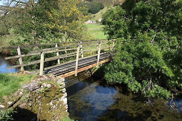 BTO55.jpg (taken 24.9.2010) 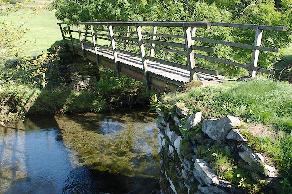 BTO56.jpg (taken 24.9.2010) |
||
|
|
||
| evidence:- | old map:- OS County Series (Wmd 33 4) |
|
| source data:- | Maps, County Series maps of Great Britain, scales 6 and 25
inches to 1 mile, published by the Ordnance Survey, Southampton,
Hampshire, from about 1863 to 1948.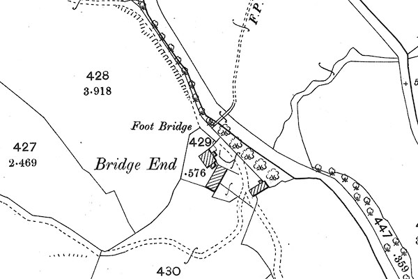 BII73.jpg |
|
|
|
||
| evidence:- | descriptive text:- |
|
| source data:- | Royal Commission on Historical Monuments in England: 1936: Inventory of the Historical
Monuments in Westmorland: HMSO "FOOTBRIDGE, over the Sprint at Bridge End ... consists of two rubble abutments approached
by ramps and connected by a wooden foot-bridge. The bridge was repaired in 1672." |
|
|
|
||
| evidence:- | map:- OS Six Inch (1956) |
|
| source data:- | Map series, various editions with the national grid, scale about
6 inches to 1 mile, published by the Ordnance Survey,
Southampton, Hampshire, scale 1 to 10560 from 1950s to 1960s,
then 1 to 10000 from 1960s to 2000s, superseded by print on
demand from digital data.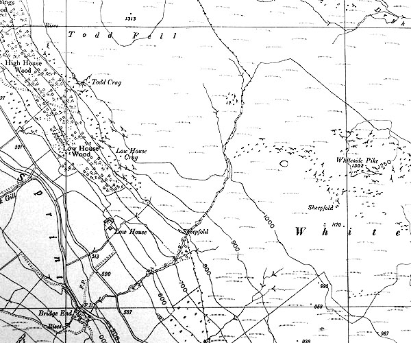 SINY5101.jpg "F.B." |
|
|
|
||
 Lakes Guides menu.