

 click to enlarge
O75E04.jpg
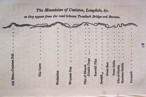
p.97 in A Concise Description of the English Lakes, by Jonathan Otley, 4th edition, 1830.
printed at top:- "The Mountains of Coniston, Langdale, &c. / as they appear from the road between Troutbeck Bridge and Bowness."
printed at bottom:- "Old Man - Coniston Fell / The Carrs / Wetherlam / Wrynose Gap / Pike of Bliscow / Crinkle Crags / Scawfell Pike / Bowfell / Great End / Great Gable / Pike of Stickle / Harrison Stickle / Paveyark"
item:- Armitt Library : A1175.4
Image © see bottom of page
 click to enlarge
OT2E01.jpg
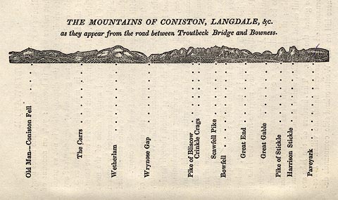
Printed on p.7 of A Concise Description of the English Lakes, by Jonathan Otley, 5th edition, 1834.
printed at top:- "THE MOUNTAINS OF CONISTON, LANGDALE, &c. / as they appear from the road between Troutbeck Bridge and Bowness."
printed at bottom:- "Old Man - Coniston Fell / The Carrs / Wetherlam / Wrynose Gap / Pike of Bliscow / Crinkle Crags / Bowfell / Great End / Great Gable / Pike of Stickle / Harrison Stickle / Paveyark"
item:- JandMN : 48.2
Image © see bottom of page
 click to enlarge
O80E03.jpg
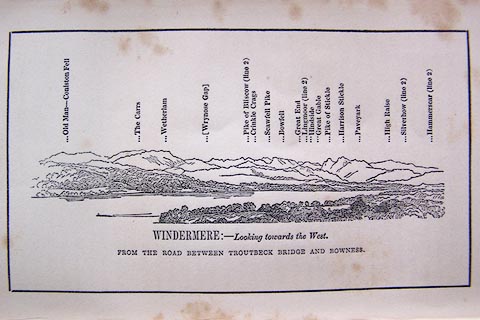
Opposite p.4 of A Descriptive Guide of the English Lakes, by Jonathan Otley, 8th edition, 1849.
printed at bottom:- "WINDERMERE: - Looking towards the West. / FROM THE ROAD BETWEEN TROUTBECK AND BOWNESS."
printed at top:- "Old Man - Coniston Fell / The Carrs / Wetherlam / (Wrynose Gap) / Pike of Bliscow (line 2) / Crinkle Crags / Scawfell Pike / Bowfell / Great End / Lingmoor (line 2) / Hindside / Great Gable / Pike of Stickle / Harrison Stickle / Paveyark / High Raise / Silverhow (line 2) / Hammerscar (line 2)"
Looking WNW; 60 degree view, WbyS to NW. This is a 'viewpoint' on some OS maps.
item:- Armitt Library : A1180.4
Image © see bottom of page

 Lakes Guides menu.