

 click to enlarge
O75E09.jpg
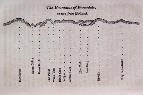
p.131 in A Concise Description of the English Lakes, by Jonathan Otley, 4th edition, 1830.
printed at top:- "The Mountains of Ennerdale: / as seen from Kirkland."
printed at bottom:- "Herdhouse / Green Gable / Great Gable / The Pillar / Wind Yate / Black Crag / Steeple / Matlin Cove / Hay Cock / Iron Crag / Revelin / Crag Fell - Grike"
item:- Armitt Library : A1175.9
Image © see bottom of page
 click to enlarge
OT2E06.jpg
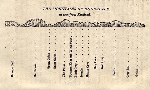
Printed on p.27 of A Concise Description of the English Lakes, by Jonathan Otley, 5th edition, 1834.
printed at top:- "THE MOUNTAINS OF ENNERDALE: / as seen from Kirkland."
printed at bottom:- "Bannow Fell / Herdhouse / Green Gable / Great Gable / The Pillar / Bowness Knot and Wind Yate / Black Crag / Steeple / Matlin Cove / Hay Cock / Iron Crag / Revelin / Crag Fell / Grike"
item:- JandMN : 48.7
Image © see bottom of page
 click to enlarge
O80E11.jpg
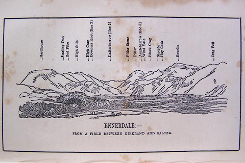
Opposite p.20 of A Descriptive Guide of the English Lakes, by Jonathan Otley, 8th edition, 1849.
printed at bottom:- "ENNERDALE: - / FROM A FIELD BETWEEN KIRKLAND AND SALTER."
printed at top:- "Herdhouse / Starling Dod / Red Pike / High Stile / High Crag / Bowness Knot (line 3) / Latterbarrow (line 2) / Pillar Stone / Pillar / Anglebarrow (line 3) / Wind Yate / Black Crag / Steeple / Hay Cock / Revelin/ Crag Fell"
Looking ESE; 45 degree view, E to SE.
item:- Armitt Library : A1180.12
Image © see bottom of page

 Lakes Guides menu.