 Old Cumbria Gazetteer
 |
 |
|
| Dale Park, Satterthwaite | ||
| Dale Park | ||
| civil parish:- | Satterthwaite (formerly Lancashire) | |
| county:- | Cumbria | |
| locality type:- | park | |
| 1Km square:- | SD3592 (etc) | |
| 10Km square:- | SD39 | |
| SummaryText:- | cf Dale Park Beck. | |
| references:- | Otley 1818 |
|
|
|
||
| evidence:- | old map:- Otley 1818 placename:- Dalepark |
|
| source data:- | Map, uncoloured engraving, The District of the Lakes,
Cumberland, Westmorland, and Lancashire, scale about 4 miles to
1 inch, by Jonathan Otley, 1818, engraved by J and G Menzies,
Edinburgh, Scotland, published by Jonathan Otley, Keswick,
Cumberland, et al, 1833.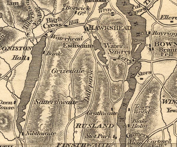 OT02SD39.jpg item:- JandMN : 48.1 Image © see bottom of page |
|
|
|
||
| evidence:- | old drawing:- Aspland 1840s-60s placename:- Dale Park |
|
| source data:- | Drawing, pencil, Dale Park, Satterthwaite, Lancashire, by Theophilus Lindsey Aspland,
about 1868-69.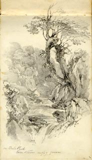 click to enlarge click to enlargeAS0601.jpg "In Dale Park / tree stems mossy green" page number "1" item:- Armitt Library : 2008.61.1 Image © see bottom of page |
|
|
|
||
| evidence:- | old drawing:- Aspland 1840s-60s placename:- Dale Park |
|
| source data:- | Drawing, pencil, Dale Park, Satterthwaite, Lancashire, by Theophilus Lindsey Aspland,
about 1868-69.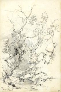 click to enlarge click to enlargeAS0602.jpg "In Dale Park" page number "2" item:- Armitt Library : 2008.61.2 Image © see bottom of page |
|
|
|
||
| evidence:- | perhaps old drawing:- Aspland 1840s-60s |
|
| source data:- | Drawing, pencil, perhaps in Dale Park, Satterthwaite, Lancashire, by Theophilus Lindsey
Aspland, about 1868-69.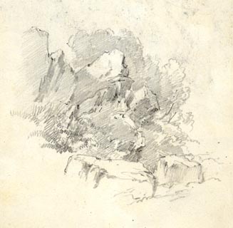 click to enlarge click to enlargeAS0603.jpg item:- Armitt Library : 2008.61.3 Image © see bottom of page |
|
|
|
||
| evidence:- | perhaps old drawing:- Aspland 1840s-60s |
|
| source data:- | Drawing, pencil, Dale Park, Satterthwaite, Lancashire, by Theophilus Lindsey Aspland,
about 1868-69.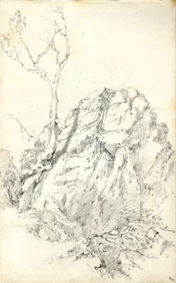 click to enlarge click to enlargeAS0604.jpg page number "3" item:- Armitt Library : 2008.61.4 Image © see bottom of page |
|
|
|
||
| evidence:- | old map:- Garnett 1850s-60s H placename:- Dalepark |
|
| source data:- | Map of the English Lakes, in Cumberland, Westmorland and
Lancashire, scale about 3.5 miles to 1 inch, published by John
Garnett, Windermere, Westmorland, 1850s-60s.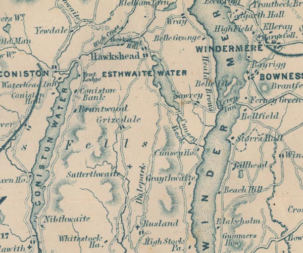 GAR2SD39.jpg "Dalepark" area item:- JandMN : 82.1 Image © see bottom of page |
|
|
|
||
 Lakes Guides menu.