 Old Cumbria Gazetteer
 |
 |
|
| Oxen House, Blawith and Subberthwaite | ||
| Oxen House | ||
| civil parish:- | Blawith and Subberthwaite (formerly Lancashire) | |
| county:- | Cumbria | |
| locality type:- | buildings | |
| coordinates:- | SD290921 | |
| 1Km square:- | SD2992 | |
| 10Km square:- | SD29 | |
|
|
||
| evidence:- | old map:- Crosthwaite 1783-94 (Con) placename:- Oxness |
|
| source data:- | Map, uncoloured engraving, An Accurate Map of Coniston Lake,
scale about 3 inches to 1 mile, by Peter Crosthwaite, Keswick,
Cumberland, 1788, version published 1809.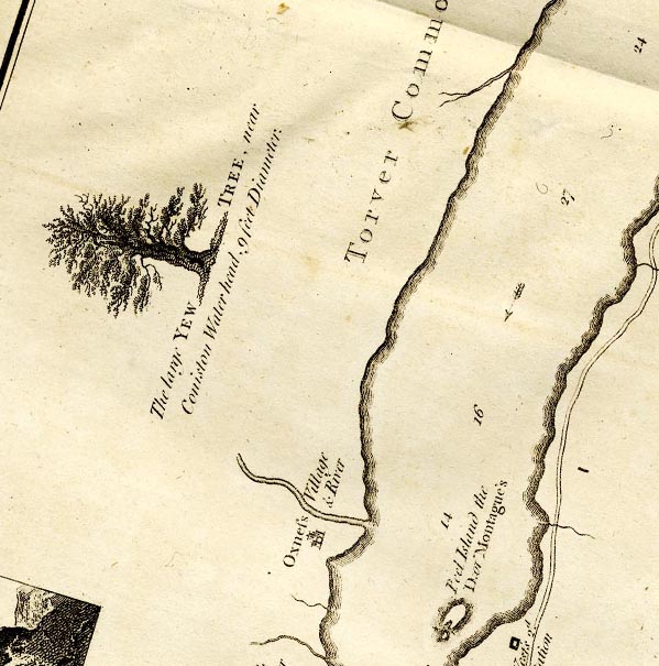 CTESD29W.jpg "Oxness Village and River" circle, buildings and tower. item:- JandMN : 182.5 Image © see bottom of page |
|
|
|
||
| evidence:- | old map:- Otley 1818 placename:- Oxen House |
|
| source data:- | Map, uncoloured engraving, The District of the Lakes,
Cumberland, Westmorland, and Lancashire, scale about 4 miles to
1 inch, by Jonathan Otley, 1818, engraved by J and G Menzies,
Edinburgh, Scotland, published by Jonathan Otley, Keswick,
Cumberland, et al, 1833.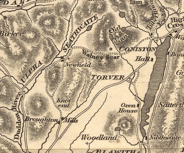 OT02SD29.jpg item:- JandMN : 48.1 Image © see bottom of page |
|
|
|
||
| evidence:- | old map:- Ford 1839 map placename:- Oxen Houses |
|
| source data:- | Map, uncoloured engraving, Map of the Lake District of
Cumberland, Westmoreland and Lancashire, scale about 3.5 miles
to 1 inch, published by Charles Thurnam, Carlisle, and by R
Groombridge, 5 Paternoster Row, London, 3rd edn 1843.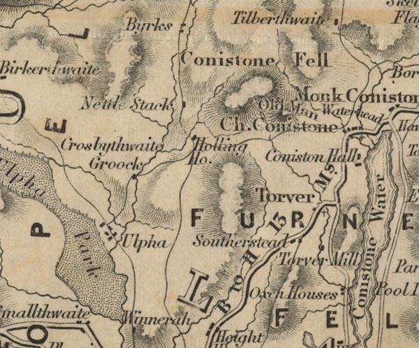 FD02SD29.jpg "Oxen Houses" item:- JandMN : 100.1 Image © see bottom of page |
|
|
|
||
| evidence:- | old map:- Garnett 1850s-60s H placename:- Oxen House |
|
| source data:- | Map of the English Lakes, in Cumberland, Westmorland and
Lancashire, scale about 3.5 miles to 1 inch, published by John
Garnett, Windermere, Westmorland, 1850s-60s.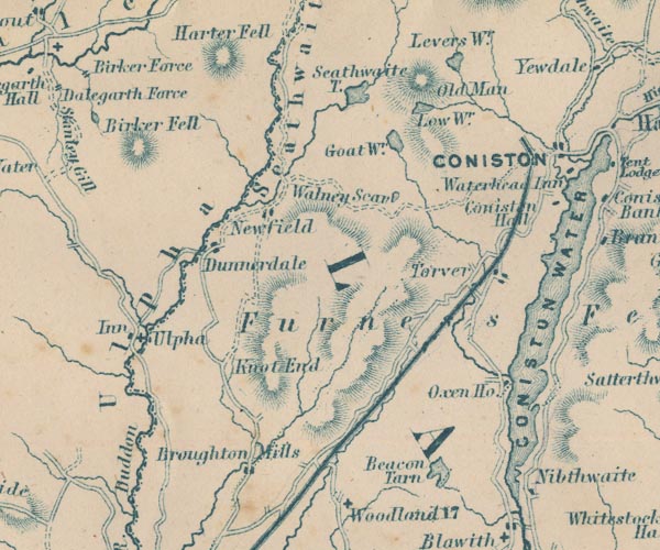 GAR2SD29.jpg "Oxen Ho." block, building item:- JandMN : 82.1 Image © see bottom of page |
|
|
|
||
 Lakes Guides menu.