 Old Cumbria Gazetteer
 |
 |
|
| Low Birker Tarn, Eskdale | ||
| runs into:- |  Low Birker Pool Low Birker Pool |
|
|
|
||
| Low Birker Tarn | ||
| civil parish:- | Eskdale (formerly Cumberland) | |
| county:- | Cumbria | |
| locality type:- | tarn | |
| coordinates:- | SD19029949 | |
| 1Km square:- | SD1999 | |
| 10Km square:- | SD19 | |
| altitude:- | 814 feet | |
| altitude:- | 248m | |
|
|
||
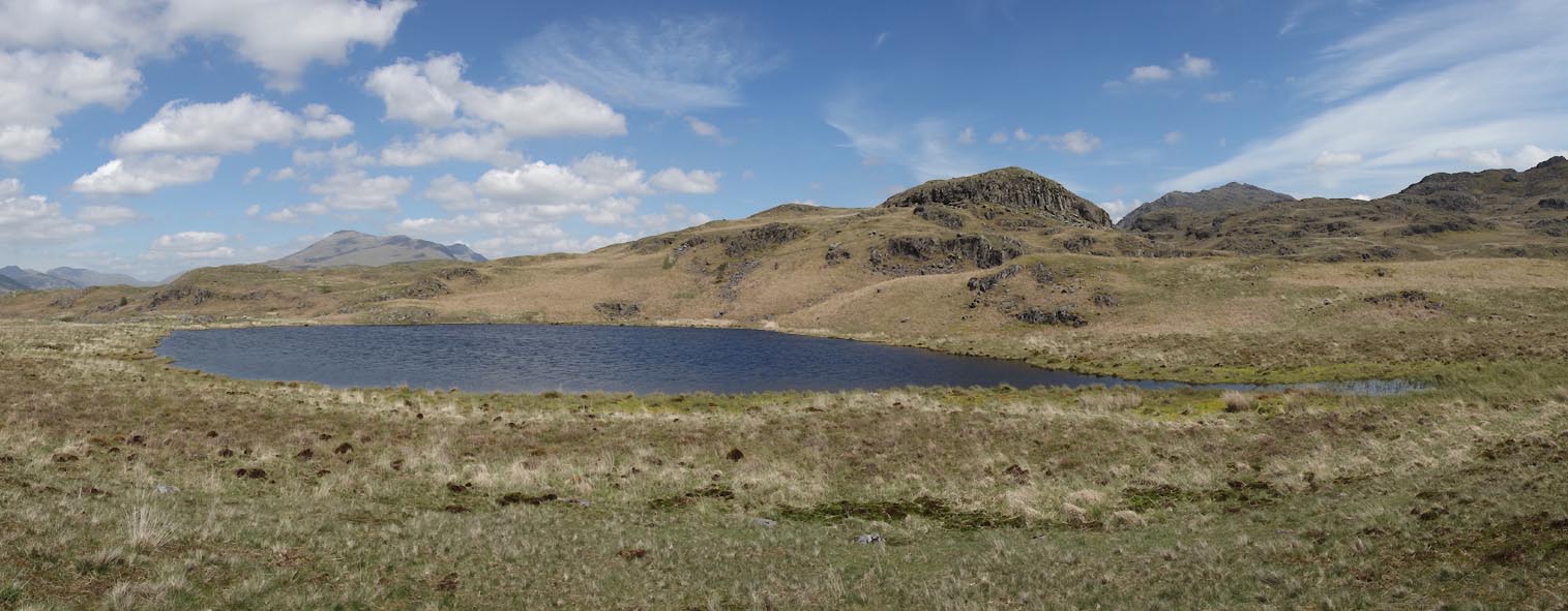 Click to enlarge CDF14.jpg (taken 4.6.2015) |
||
|
|
||
| evidence:- | old map:- OS County Series (Cmd 83 3) placename:- Low Birker Tarn placename:- Birker Tarn, Low |
|
| source data:- | Maps, County Series maps of Great Britain, scales 6 and 25
inches to 1 mile, published by the Ordnance Survey, Southampton,
Hampshire, from about 1863 to 1948. |
|
|
|
||
| evidence:- | old map:- Otley 1818 |
|
| source data:- | Map, uncoloured engraving, The District of the Lakes,
Cumberland, Westmorland, and Lancashire, scale about 4 miles to
1 inch, by Jonathan Otley, 1818, engraved by J and G Menzies,
Edinburgh, Scotland, published by Jonathan Otley, Keswick,
Cumberland, et al, 1833.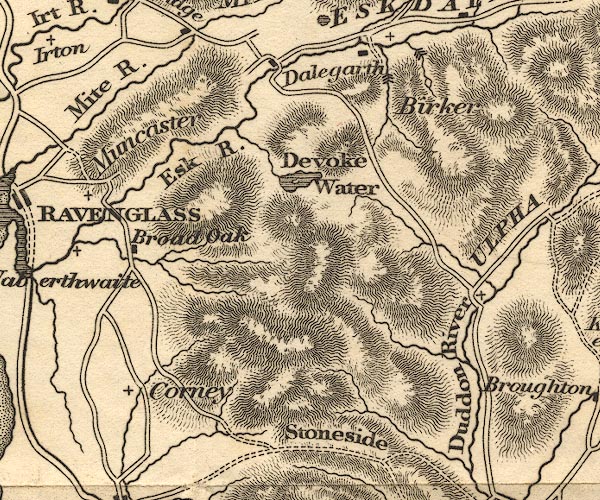 OT02SD19.jpg item:- JandMN : 48.1 Image © see bottom of page |
|
|
|
||
| evidence:- | old map:- Garnett 1850s-60s H |
|
| source data:- | Map of the English Lakes, in Cumberland, Westmorland and
Lancashire, scale about 3.5 miles to 1 inch, published by John
Garnett, Windermere, Westmorland, 1850s-60s.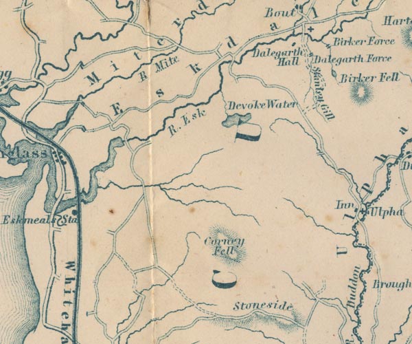 GAR2SD19.jpg outline with shore form lines, lake or tarn item:- JandMN : 82.1 Image © see bottom of page |
|
|
|
||
Lakes Guides menu.