 Old Cumbria Gazetteer
 |
 |
|
| Brayton, Aspatria | ||
| Brayton | ||
| civil parish:- | Aspatria (formerly Cumberland) | |
| county:- | Cumbria | |
| locality type:- | locality | |
| coordinates:- | NY16074214 (roughly) | |
| 1Km square:- | NY1642 | |
| 10Km square:- | NY14 | |
|
|
||
| evidence:- | old map:- Otley 1818 placename:- Brayton |
|
| source data:- | Map, uncoloured engraving, The District of the Lakes,
Cumberland, Westmorland, and Lancashire, scale about 4 miles to
1 inch, by Jonathan Otley, 1818, engraved by J and G Menzies,
Edinburgh, Scotland, published by Jonathan Otley, Keswick,
Cumberland, et al, 1833.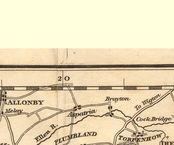 OT02NY14.jpg item:- JandMN : 48.1 Image © see bottom of page |
|
|
|
||
| evidence:- | old map:- Postlethwaite 1877 (3rd edn 1913) placename:- Brayton |
|
| source data:- | Map, uncoloured engraving, Map of the Lake District Mining Field, Westmorland, Cumberland,
Lancashire, scale about 5 miles to 1 inch, by John Postlethwaite, published by W H
Moss and Sons, 13 Lowther Street, Whitehaven, Cumberland, 1877 edn 1913.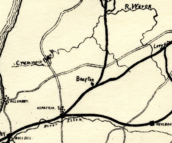 PST2NY14.jpg "Brayton" mine symbol, railways item:- JandMN : 162.2 Image © see bottom of page |
|
|
|
||
 Lakes Guides menu.