 Old Cumbria Gazetteer
 |
 |
|
| Strictland | ||
| Strickland | ||
| civil parish:- | Blennerhasset and Torpenhow (formerly Cumberland) (guess) | |
| county:- | Cumbria | |
| locality type:- | building/s (guess) | |
| 10Km square:- | NY13 (?) | |
| 1Km square:- | NY1030 | |
| 10Km square:- | NY13 (?) | |
| references:- | Ogilby 1675 |
|
|
|
||
| evidence:- | old map:- Ogilby 1675 (plate 96) placename:- Strictland |
|
| source data:- | Road strip map, hand coloured engraving, the Road from Kendal to
Cockermouth, and the Road from Egremond to Carlisle, scale about
1 inch to 1 mile, by John Ogilby, London, 1675.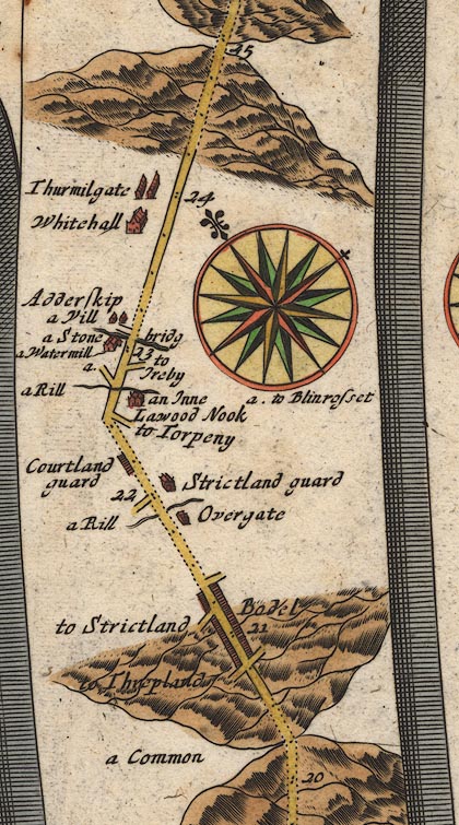 OG96Bm20.jpg In mile 21, Cumberland. Turning left:- "to Strictland" item:- JandMN : 22 Image © see bottom of page |
|
|
|
||
 Lakes Guides menu.