 Old Cumbria Gazetteer
 |
 |
|
| Shaw End, Lambrigg | ||
| Shaw End | ||
| civil parish:- | Lambrigg (formerly Westmorland) | |
| county:- | Cumbria | |
| locality type:- | buildings | |
| coordinates:- | SD59719607 | |
| 1Km square:- | SD5996 | |
| 10Km square:- | SD59 | |
|
|
||
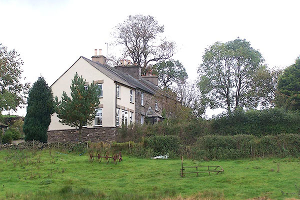 BMW62.jpg (taken 20.10.2006) |
||
|
|
||
| evidence:- | old map:- OS County Series (Wmd 34 15) placename:- Shaw End |
|
| source data:- | Maps, County Series maps of Great Britain, scales 6 and 25
inches to 1 mile, published by the Ordnance Survey, Southampton,
Hampshire, from about 1863 to 1948. |
|
|
|
||
| evidence:- | road book:- Cary 1798 (2nd edn 1802) placename:- Shaw End |
|
| source data:- | Road book, itineraries, Cary's New Itinerary, by John Cary, 181
Strand, London, 2nd edn 1802. goto source goto source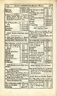 click to enlarge click to enlargeC38315.jpg page 315-316 "About 4 Miles from Kendal, on l. is Shaw End, Arthur Shepherd, Esq." item:- JandMN : 228.1 Image © see bottom of page |
|
|
|
||
Lakes Guides menu.