 Old Cumbria Gazetteer
 |
 |
|
| Pardshaw Crag, Pardshaw Hall | ||
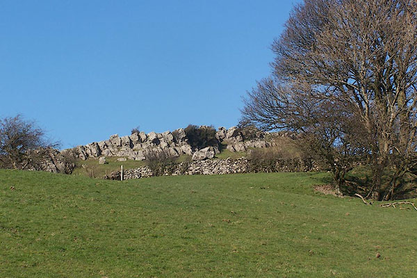
| Pardshaw Crag | ||
| locality:- | Pardshaw Hall | |
| civil parish:- | Dean (formerly Cumberland) | |
| county:- | Cumbria | |
| locality type:- | rocks | |
| locality type:- | quaker meeting | |
| coordinates:- | NY10272566 (etc) | |
| 1Km square:- | NY1025 | |
| 10Km square:- | NY12 | |
|
|
||
 BNK58.jpg (taken 24.3.2007) 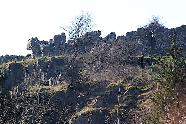 BNK57.jpg (taken 24.3.2007) |
||
|
|
||
| evidence:- | old map:- OS County Series (Cmd 54 15) placename:- Pardshaw Crag |
|
| source data:- | Maps, County Series maps of Great Britain, scales 6 and 25
inches to 1 mile, published by the Ordnance Survey, Southampton,
Hampshire, from about 1863 to 1948. |
|
|
|
||
| evidence:- | old map:- Donald 1774 (Cmd) placename:- Pardshaw Crag |
|
| source data:- | Map, hand coloured engraving, 3x2 sheets, The County of Cumberland, scale about 1
inch to 1 mile, by Thomas Donald, engraved and published by Joseph Hodskinson, 29
Arundel Street, Strand, London, 1774.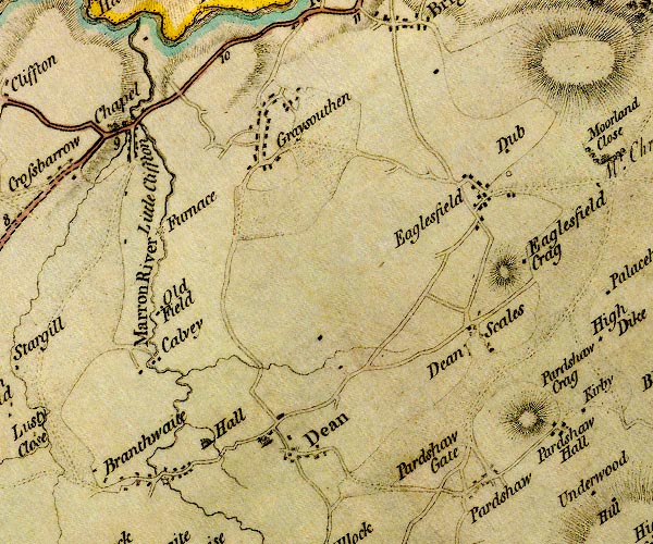 D4NY02NE.jpg "Pardshaw Crag" hill hachuring; a hill or mountain item:- Carlisle Library : Map 2 Image © Carlisle Library |
|
|
|
||
| hearsay:- |
George Fox, quaker, preached here to a large crowd, benefiting from the natural acoustics,
about 1653. It is said he stood on two blocks of limestone known now as Fox's Pulpit. |
|
| Neale Dow, an american temperance promoter, spoke to a crowd of more than 5000 here,
1857. Another report says 14000 people and the local pubs ran out of beer! |
||
|
|
||
 Lakes Guides menu.