 Old Cumbria Gazetteer
 |
 |
|
| Newby Bridge, Newby East | ||
| Newby Bridge | ||
| site name:- | Irthing, River | |
| locality:- | Newby East | |
| civil parish:- | Irthington (formerly Cumberland) | |
| civil parish:- | Hayton (formerly Cumberland) | |
| county:- | Cumbria | |
| locality type:- | bridge | |
| coordinates:- | NY47675807 | |
| 1Km square:- | NY4758 | |
| 10Km square:- | NY45 | |
|
|
||
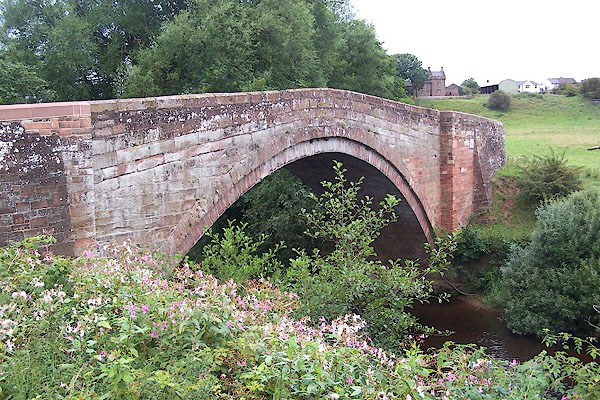 BMO13.jpg (taken 25.8.2006) |
||
|
|
||
| evidence:- | old map:- OS County Series (Cmd 17 15) placename:- Newby Bridge |
|
| source data:- | Maps, County Series maps of Great Britain, scales 6 and 25
inches to 1 mile, published by the Ordnance Survey, Southampton,
Hampshire, from about 1863 to 1948. |
|
|
|
||
| evidence:- | old map:- Donald 1774 (Cmd) |
|
| source data:- | Map, hand coloured engraving, 3x2 sheets, The County of Cumberland, scale about 1
inch to 1 mile, by Thomas Donald, engraved and published by Joseph Hodskinson, 29
Arundel Street, Strand, London, 1774.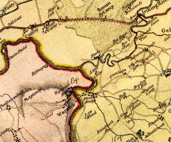 D4NY45NE.jpg double line across a river; a bridge over the Irthing at Newby item:- Carlisle Library : Map 2 Image © Carlisle Library |
|
|
|
||
| evidence:- | old map:- Bell 1892 placename:- Newby Bridge |
|
| source data:- | Map, colour lithograph, Road Map of Cumberland, by George Joseph
Bell, scale about 2.5 miles to 1 inch, printed by Charles
Thurnam and Sons, Carlisle, Cumberland, 1892.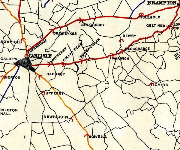 BEL9NY45.jpg "NEWBY" bridge symbol Road map of Cumberland showing County Bridges item:- Carlisle Library : Map 38 Image © Carlisle Library |
|
|
|
||
| evidence:- | database:- Listed Buildings 2010 placename:- Newby Bridge |
|
| source data:- | courtesy of English Heritage "NEWBY BRIDGE / / / HAYTON / CARLISLE / CUMBRIA / II / 78045 / NY4768058070" |
|
| source data:- | courtesy of English Heritage "Road bridge over the River Irthing. Late C18 or early C19. Dressed red sandstone. High single rounded arch with 2 courses of voussoirs. Humped back and single track width, parapet raised late C19. Ramped approach walls are late C19. Lies partly in Irthington C.P." |
|
|
|
||
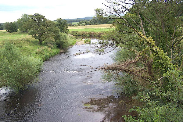 BMO14.jpg View of river. (taken 25.8.2006) |
||
|
|
||
 Lakes Guides menu.