 Old Cumbria Gazetteer
 |
 |
|
| Mislet Brow, Windermere | ||
| Mislet Brow | ||
| site name:- | road, Kendal to Windermere | |
| locality:- | Mislet | |
| civil parish:- | Windermere (formerly Westmorland) | |
| county:- | Cumbria | |
| locality type:- | road | |
| locality type:- | hill (?) | |
| coordinates:- | SD43099977 (etc) | |
| 1Km square:- | SD4399 | |
| 10Km square:- | SD49 | |
|
|
||
| evidence:- | old map:- OS County Series (Wmd 32 4) placename:- Mislet Brow |
|
| source data:- | Maps, County Series maps of Great Britain, scales 6 and 25
inches to 1 mile, published by the Ordnance Survey, Southampton,
Hampshire, from about 1863 to 1948. |
|
|
|
||
| evidence:- | old map:- Ogilby 1675 (plate 96) |
|
| source data:- | Road strip map, hand coloured engraving, the Road from Kendal to
Cockermouth, and the Road from Egremond to Carlisle, scale about
1 inch to 1 mile, by John Ogilby, London, 1675.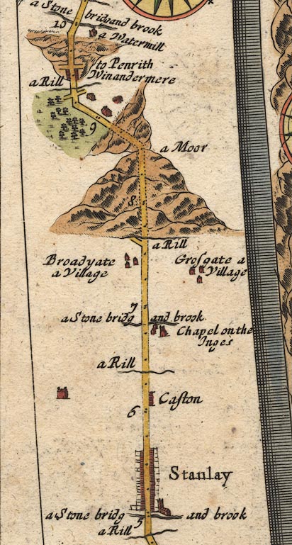 OG96m005.jpg In mile 8, Westmoreland. Road ascends a big hill and descends less. item:- JandMN : 22 Image © see bottom of page |
|
|
|
||
 Lakes Guides menu.