 Old Cumbria Gazetteer
 |
 |
|
| Low Garth, Bewaldeth | ||
| Low Garth | ||
| Crag View | ||
| locality:- | Bewaldeth | |
| civil parish:- | Bewaldeth and Snittlegarth (formerly Cumberland) | |
| county:- | Cumbria | |
| locality type:- | buildings | |
| coordinates:- | NY21013476 | |
| 1Km square:- | NY2134 | |
| 10Km square:- | NY23 | |
| SummaryText:- | Divided into two dwellings. | |
|
|
||
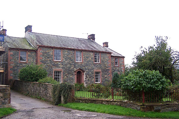 BMR91.jpg (taken 29.9.2006) |
||
|
|
||
| evidence:- | old map:- OS County Series (Cmd 46 12) placename:- Lowgarth |
|
| source data:- | Maps, County Series maps of Great Britain, scales 6 and 25
inches to 1 mile, published by the Ordnance Survey, Southampton,
Hampshire, from about 1863 to 1948. |
|
|
|
||
| evidence:- | database:- Listed Buildings 2010 placename:- Low Garth item:- date stone (1746) |
|
| source data:- | courtesy of English Heritage "LOW GARTH / / / BEWALDETH AND SNITTLEGARTH / ALLERDALE / CUMBRIA / II / 72118 / NY2101834764" |
|
|
|
||
| evidence:- | database:- Listed Buildings 2010 |
|
| source data:- | courtesy of English Heritage "BARNS AND BYRES TO NORTH WEST OF LOW GARTH AND CRAG VIEW / / / BEWALDETH AND SNITTLEGARTH / ALLERDALE / CUMBRIA / II / 72120 / NY2103834787" |
|
|
|
||
| evidence:- | database:- Listed Buildings 2010 |
|
| source data:- | courtesy of English Heritage "GARDEN WALL AND GATE PIERS IN FRONT OF LOW GARTH AND CRAG VIEW / / / BEWALDETH AND SNITTLEGARTH / ALLERDALE / CUMBRIA / II / 72119 / NY2100434785" |
|
|
|
||
 Lakes Guides menu.