 Old Cumbria Gazetteer
 |
 |
|
| Hucks Bridge Inn, Fawcett Forest | ||
| Hucks Bridge Inn | ||
| Greenside View | ||
| Shapellon | ||
| locality:- | Hucks Bridge | |
| civil parish:- | Fawcett Forest (formerly Westmorland) | |
| county:- | Cumbria | |
| locality type:- | buildings | |
| locality type:- | inn (once) | |
| coordinates:- | NY55250399 | |
| 1Km square:- | NY5503 | |
| 10Km square:- | NY50 | |
|
|
||
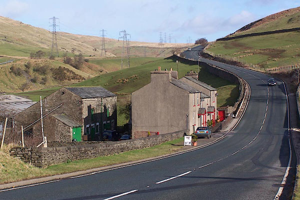 BNH73.jpg (taken 9.3.2007) |
||
|
|
||
| evidence:- | old map:- OS County Series (Wmd 28) placename:- Bay Horse |
|
| source data:- | Maps, County Series maps of Great Britain, scales 6 and 25
inches to 1 mile, published by the Ordnance Survey, Southampton,
Hampshire, from about 1863 to 1948. "Bay Horse P.H." |
|
|
|
||
| evidence:- | probably old map:- Otley 1818 placename:- Halfway House |
|
| source data:- | Map, uncoloured engraving, The District of the Lakes,
Cumberland, Westmorland, and Lancashire, scale about 4 miles to
1 inch, by Jonathan Otley, 1818, engraved by J and G Menzies,
Edinburgh, Scotland, published by Jonathan Otley, Keswick,
Cumberland, et al, 1833.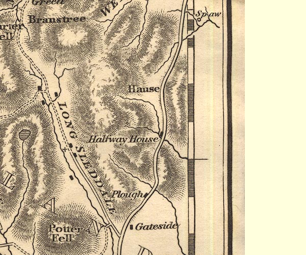 OT02NY50.jpg item:- JandMN : 48.1 Image © see bottom of page |
|
|
|
||
| evidence:- | old text:- Harper 1907 placename:- Bay Horse |
|
| source data:- | HP01p111.txt Page 111:- "..." 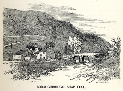 click to enlarge click to enlargeHP0108.jpg "BOROUGHBRIDGE, SHAP FELL." "... Hucks Brow, the end of the first stage out of Kendal, ... Another rise of a mile and a half, and a steep descent leads to Boroughbridge, a hamlet where an ancient bridge spans a mountain stream and is neighboured by a few cottages and the "Bay Horse" inn. ..." item:- JandMN : 1055.9 Image © see bottom of page |
|
|
|
||
| evidence:- | old map:- Burrow 1920s |
|
| source data:- | Road book, On the Road, Dunlop Pictorial Road Plans, volume V,
strip maps with parts in Westmorland, Cumberland etc, irregular
scale about 1.5 miles to 1 inch, by E J Burrow and Co,
Cheltenham, Gloucestershire, 1920s.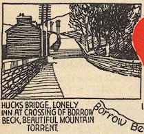 EJB3Vg13.jpg item:- private collection : 17 Image © see bottom of page |
|
|
|
||
 Lakes Guides menu.