 Old Cumbria Gazetteer
 |
 |
|
| Horse House, Fawcett Forest | ||
| Horse House | ||
| locality:- | Hucks Bridge | |
| civil parish:- | Fawcett Forest (formerly Westmorland) | |
| county:- | Cumbria | |
| locality type:- | buildings | |
| locality type:- | barn | |
| locality type:- | stable (?) | |
| coordinates:- | NY55120418 (?) | |
| 1Km square:- | NY5504 | |
| 10Km square:- | NY50 | |
| references:- | Ogilby 1675 |
|
|
|
||
| evidence:- | old map:- Ogilby 1675 (plate 38) placename:- Horse House |
|
| source data:- | Road strip map, hand coloured engraving, continuation of the
Road from London to Carlisle, scale about 1 inch to 1 mile, by
John Ogilby, London, 1675.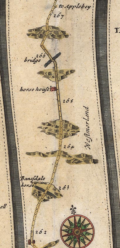 OG38m262.jpg In mile 265, Westmorland. "horse house" house drawn on the left of the road. item:- JandMN : 21 Image © see bottom of page |
|
|
|
||
| evidence:- | old map:- Morden 1695 (Wmd) placename:- Horse Hause |
|
| source data:- | Map, hand coloured engraving, Westmorland, scale about 2.5 miles to 1 inch, by Robert
Morden, published by Abel Swale, the Unicorn, St Paul's Churchyard, Awnsham, and John
Churchill, the Black Swan, Paternoster Row, London, 1695. MD10NY50.jpg "Horse Hause" Perhaps a pass, no symbol. item:- JandMN : 24 Image © see bottom of page |
|
|
|
||
| evidence:- | old map:- Bowen 1720 (plate 94) placename:- Horse House |
|
| source data:- | Strip maps, uncoloured engravings, road maps, The Road from
London to Carlisle, scale about 2 miles to 1 inch, with sections
in Lancashire and Westmorland, published by Emanuel Bowen, St
Katherines, London, 1720.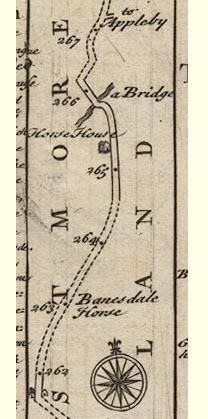 B094m262.jpg "Horse House" At mile 265+. item:- Dove Cottage : 2007.38.100 Image © see bottom of page |
|
|
|
||
| evidence:- | old map:- Millward and Dickinson 1737 placename:- Horsehouse |
|
| source data:- | Road map, photocopy, diagram, A New and Correct Map of Roads of
England, probably published by T Millward and B Dickinson, Inigo
Jones's Head, Fleet Street, London, 1737. "Horsehouse"  click to enlarge click to enlargeMWD1Cm.jpg item:- private collection : 264 Image © see bottom of page |
|
|
|
||
| evidence:- | old map:- Badeslade 1742 placename:- Horse House |
|
| source data:- | Map, uncoloured engraving, A Map of Westmorland North from
London, scale about 10 miles to 1 inch, with descriptive text,
by Thomas Badeslade, London, engraved and published by William
Henry Toms, Union Court, Holborn, London, 1742. click to enlarge click to enlargeBD12.jpg "Horse House" circle, italic lowercase text; village, hamlet or locality item:- Dove Cottage : 2007.38.62 Image © see bottom of page |
|
|
|
||
| evidence:- | old map:- Simpson 1746 map (Wmd) placename:- Horse House |
|
| source data:- | Map, uncoloured engraving, Westmorland, scale about 8 miles to 1
inch, printed by R Walker, Fleet Lane, London, 1746.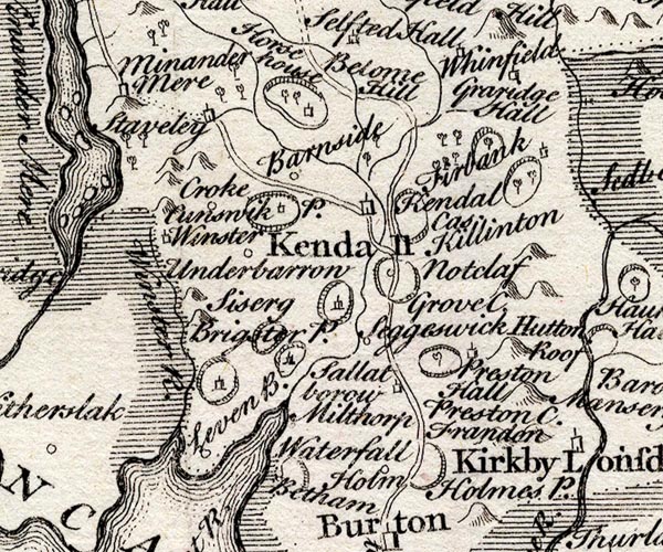 SMP2SDP.jpg "Horse House" Building. item:- Dove Cottage : 2007.38.59 Image © see bottom of page |
|
|
|
||
| evidence:- | old map:- Bowen and Kitchin 1760 placename:- Horse House |
|
| source data:- | Map, hand coloured engraving, A New Map of the Counties of
Cumberland and Westmoreland Divided into their Respective Wards,
scale about 4 miles to 1 inch, by Emanuel Bowen and Thomas
Kitchin et al, published by T Bowles, Robert Sayer, and John
Bowles, London, 1760.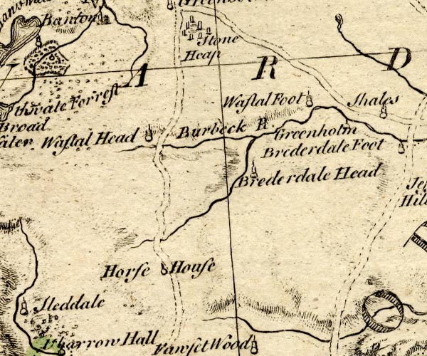 BO18NY40.jpg "Horse House" circle and line, by the road item:- Armitt Library : 2008.14.10 Image © see bottom of page |
|
|
|
||
| hearsay:- |
John Ogilby shows and names a house here. The present farm buildings are not regarded
as barn by the farmers, nor thought to have been domestic. |
|
| Though ... other opinions have been expressed. |
||
|
|
||
 Lakes Guides menu.