button to main menu  Old Cumbria Gazetteer
Chapel House, Kirkoswald
Chapel House
civil parish:-   Kirkoswald (formerly Cumberland)
county:-   Cumbria
locality type:-   chapel (ex) 
locality type:-   buildings
coordinates:-   NY58804208
1Km square:-   NY5842
10Km square:-   NY54


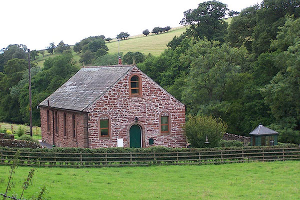
photograph
BMM26.jpg (taken 11.8.2006)  

evidence:-   old map:- OS County Series (Cmd 40 7) 
placename:-  Parkhead Chapel
source data:-   Maps, County Series maps of Great Britain, scales 6 and 25 inches to 1 mile, published by the Ordnance Survey, Southampton, Hampshire, from about 1863 to 1948.
"Parkhead Chapel (Independent) / Grave Yard"

evidence:-   database:- Listed Buildings 2010
source data:-  
courtesy of English Heritage
"FORMER CONGREGATIONAL CHURCH / / / KIRKOSWALD / EDEN / CUMBRIA / II / 73493 / NY5880042084"
source data:-  
courtesy of English Heritage
"House formerly church. Probably C18 (founded 1683). Random red sandstone rubble walls with raised quoins; Welsh slate roof. Single storey, 4 bays. 4 round headed lancet windows have inserted C20 sashes with glazing bars with blocked heads. Side entrance right has C20 door in original round arch."

button to lakes menu  Lakes Guides menu.