 Old Cumbria Gazetteer
 |
 |
|
| Buck Stone, Lancashire | ||
| Buck Stone | ||
| county:- | Lancashire | |
| locality type:- | boundary stone (?) | |
| locality type:- | stone | |
| locality type:- | county boundary mark | |
| coordinates:- | SD52267466 | |
| 1Km square:- | SD5274 | |
| 10Km square:- | SD57 | |
| old boundary | ||
| locality:- | Westmorland boundary | |
|
|
||
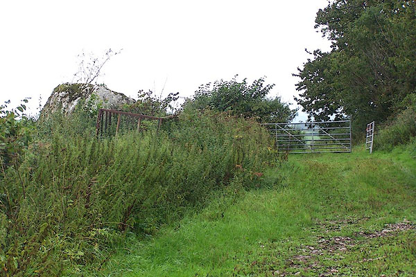 BMN57.jpg (taken 20.8.2006) 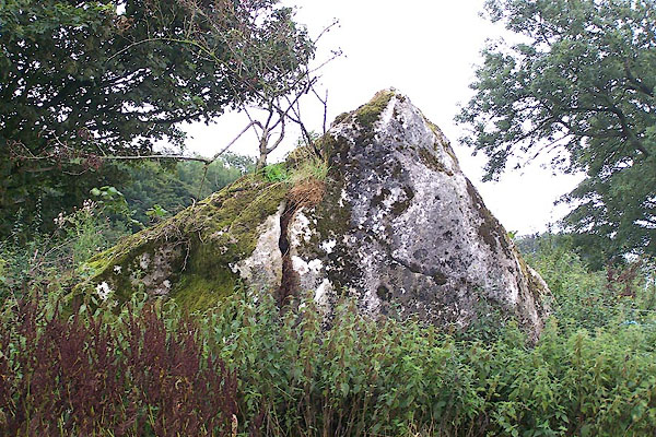 BMN58.jpg (taken 20.8.2006) |
||
|
|
||
| evidence:- | possibly old map:- Mercator 1595 (edn?) placename:- |
|
| source data:- | Map, hand coloured engraving, Westmorlandia, Lancastria, Cestria
etc, ie Westmorland, Lancashire, Cheshire etc, scale about 10.5
miles to 1 inch, by Gerard Mercator, Duisberg, Germany, 1595,
edition 1613-16. MER5WmdA.jpg "" stone near the county boundary with Lancashire item:- Armitt Library : 2008.14.3 Image © see bottom of page |
|
|
|
||
| evidence:- | old map:- Ogilby 1675 (plate 38) placename:- Birk Stone |
|
| source data:- | Road strip map, hand coloured engraving, continuation of the
Road from London to Carlisle, scale about 1 inch to 1 mile, by
John Ogilby, London, 1675.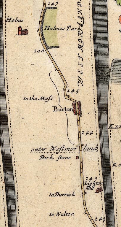 OG38m242.jpg In mile 243, Lancashire. "Birk stone" a stone, just south of the Lancashire Westmorland county boundary. item:- JandMN : 21 Image © see bottom of page |
|
|
|
||
| evidence:- | old map:- Bowen 1720 (plate 93) placename:- Birk Stone |
|
| source data:- | Strip maps, uncoloured engravings, road maps, The Road from
London to Carlisle, scale about 2 miles to 1 inch, with sections
in Lancashire and Westmorland, published by Emanuel Bowen, St
Katherines, London, 1720.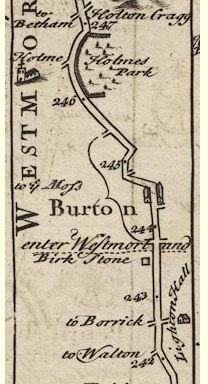 B093m242.jpg In mile 243, Lancashire. "Birk Stone" item:- Dove Cottage : 2007.38.100 Image © see bottom of page |
|
|
|
||
| evidence:- | old map:- Bowen and Kitchin 1760 placename:- Birkstone |
|
| source data:- | Map, hand coloured engraving, A New Map of the Counties of
Cumberland and Westmoreland Divided into their Respective Wards,
scale about 4 miles to 1 inch, by Emanuel Bowen and Thomas
Kitchin et al, published by T Bowles, Robert Sayer, and John
Bowles, London, 1760.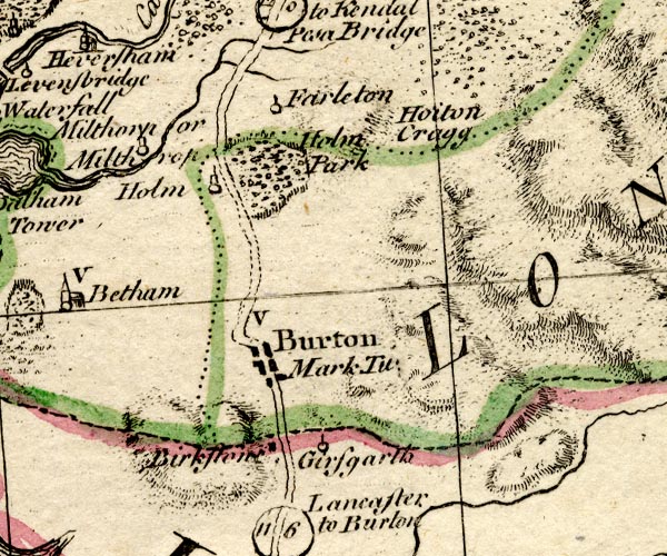 BO18SD47.jpg "Birkstone" block, east side of road, Lancashire side of county boundary Westmorland Lancashire item:- Armitt Library : 2008.14.10 Image © see bottom of page |
|
|
|
||
| evidence:- | old text:- Harper 1907 placename:- Buckstone, The |
|
| source data:- | HP01p094.txt Page 94:- "... a huge granite crag, called from time immemorial "the Buckstone," stands in the hedgerow and recalls the trials of travellers in a bygone age, when roads were little better than winding tracks and sign-posts did not exist. They went, those palpitating travellers, as directed, "past the Buckstone," standing for centuries as sure a landmark as anything in this countryside. And now it is forgotten, except by the farming and field-folk and those whose business or pleasure is in the byways and hedges. ..." "..." HP01p097.txt Page 97:- "..." 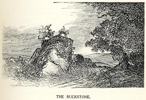 click to enlarge click to enlargeHP0103.jpg "THE BUCKSTONE." "..." item:- JandMN : 1055.4 Image © see bottom of page |
|
|
|
||
 Lakes Guides menu.