 Old Cumbria Gazetteer
 |
 |
|
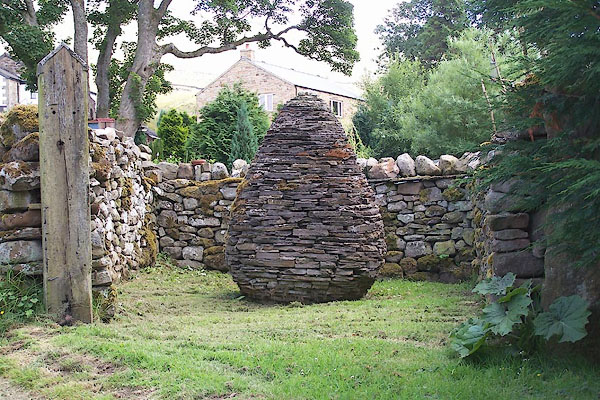
| Outhgill Pinfold, Outhgill | ||
| Outhgill Pinfold | ||
| locality:- | Outhgill | |
| civil parish:- | Mallerstang (formerly Westmorland) | |
| county:- | Cumbria | |
| locality type:- | pinfold | |
| locality type:- | cone pinfold | |
| locality type:- | sculpture | |
| coordinates:- | NY78380160 | |
| 1Km square:- | NY7801 | |
| 10Km square:- | NY70 | |
|
|
||
 BMK65.jpg (taken 21.7.2006) 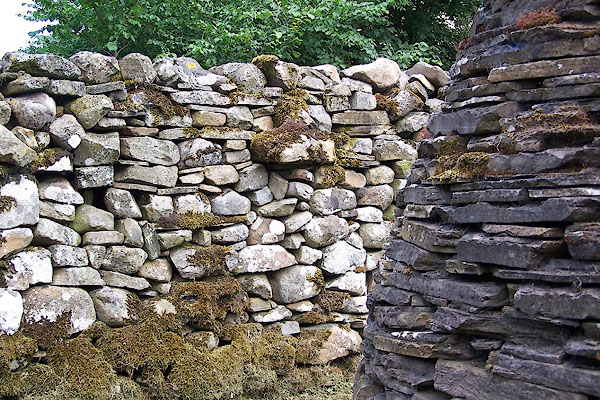 BMK66.jpg (taken 21.7.2006) |
||
|
|
||
| evidence:- | old map:- OS County Series (Wmd 30 15) |
|
| source data:- | Maps, County Series maps of Great Britain, scales 6 and 25
inches to 1 mile, published by the Ordnance Survey, Southampton,
Hampshire, from about 1863 to 1948. "Pinfold" |
|
|
|
||
| :- |
Renewed by Andy Goldsworthy as part of the Sheepfolds project, 1996-2002. |
|
| Up the lane at the telephone kiosk, behind a converted barn. |
||
| One of six pinfolds with a cone sculpture:- |
||
| "... guardian of a village or a seed within the outer protective shell of the pinfold
..." |
||
| : 2002 (?): Andy Goldsworthy Sheepfolds: Cumbria CC (?):: leaflet from TIC www.sheepfolds.org |
||
|
|
||
 Lakes Guides menu.