 Old Cumbria Gazetteer
 |
 |
|
| Killington Hall, Killington | ||
| Killington Hall | ||
| locality:- | Killington | |
| civil parish:- | Killington (formerly Westmorland) | |
| county:- | Cumbria | |
| locality type:- | buildings | |
| coordinates:- | SD61308901 | |
| 1Km square:- | SD6189 | |
| 10Km square:- | SD68 | |
|
|
||
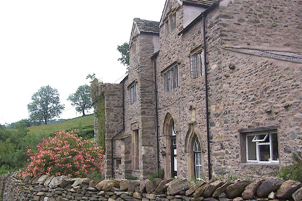 BMG53.jpg (taken 16.6.2006) 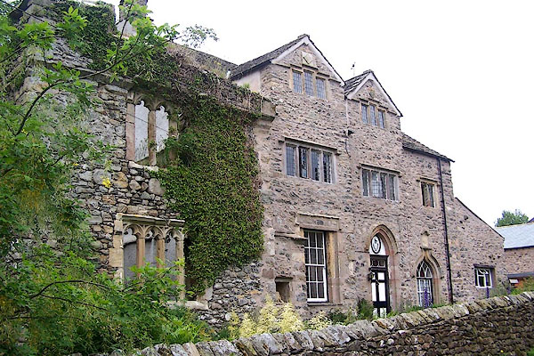 BMG55.jpg (taken 16.6.2006) |
||
|
|
||
| evidence:- | old map:- OS County Series (Wmd 39 16) placename:- Hall placename:- Killington Hall |
|
| source data:- | Maps, County Series maps of Great Britain, scales 6 and 25
inches to 1 mile, published by the Ordnance Survey, Southampton,
Hampshire, from about 1863 to 1948. |
|
|
|
||
| evidence:- | hearth tax returns:- Hearth Tax 1675 placename:- Killingworth Hall |
|
| source data:- | Records, hearth tax survey returns, Westmorland, 1674/75. "Killingworth Hall" in "Killington in Lonsdale ward" |
|
|
|
||
| evidence:- | old map:- Jefferys 1770 (Wmd) |
|
| source data:- | Map, 4 sheets, The County of Westmoreland, scale 1 inch to 1
mile, surveyed 1768, and engraved and published by Thomas
Jefferys, London, 1770.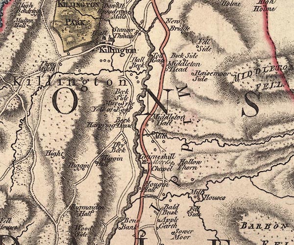 J5SD68NW.jpg "Hall" house item:- National Library of Scotland : EME.s.47 Image © National Library of Scotland |
|
|
|
||
| evidence:- | old map:- Cary 1789 (edn 1805) |
|
| source data:- | Map, uncoloured engraving, Westmoreland, scale about 2.5 miles
to 1 inch, by John Cary, London, 1789; edition 1805.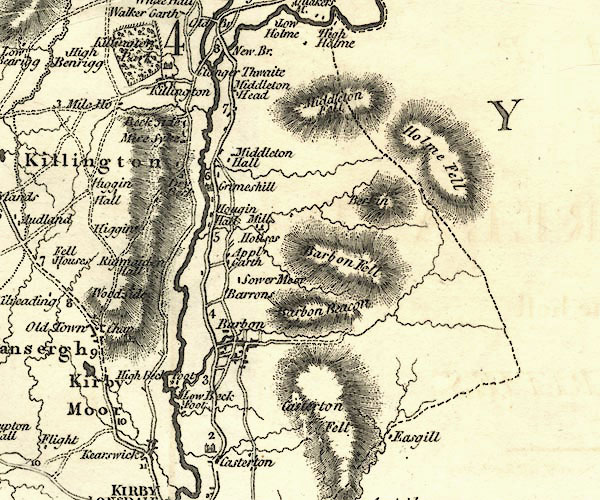 CY24SD68.jpg house symbol; large house item:- JandMN : 129 Image © see bottom of page |
|
|
|
||
| evidence:- | old map:- Hall 1820 (Wmd) placename:- Killington Park |
|
| source data:- | Map, hand coloured engraving, Westmoreland ie Westmorland, scale
about 14.5 miles to 1 inch, by Sidney Hall, London, 1820,
published by Samuel Leigh, 18 Strand, London, 1820-31. click to enlarge click to enlargeHA18.jpg "Killington Pk." outline of fence palings; park item:- Armitt Library : 2008.14.58 Image © see bottom of page |
|
|
|
||
| evidence:- | old map:- Ford 1839 map placename:- Killington Park |
|
| source data:- | Map, uncoloured engraving, Map of the Lake District of
Cumberland, Westmoreland and Lancashire, scale about 3.5 miles
to 1 inch, published by Charles Thurnam, Carlisle, and by R
Groombridge, 5 Paternoster Row, London, 3rd edn 1843.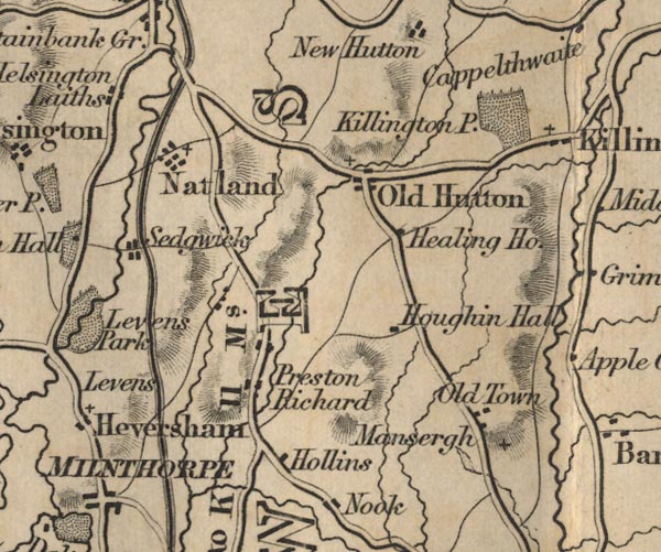 FD02SD58.jpg "Killington P." Park. item:- JandMN : 100.1 Image © see bottom of page |
|
|
|
||
| evidence:- | old photograph:- Bell 1880s-1940s placename:- Killington Hall |
|
| source data:- | Photograph, Killington Hall, Killington, Westmorland, by Herbert Bell, photographer,
Ambleside, Westmorland, 1895.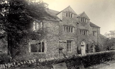 click to enlarge click to enlargeHB0180.jpg Vol.2 no.180 in an album, Examples of Early Domestic and Military Architecture in Westmorland, assembled 1910. ms at bottom:- "180. Killington Hall. Kirkby Lonsdale. L." item:- Armitt Library : 1958.3166.74 Image © see bottom of page |
|
|
|
||
| evidence:- | site plan:- Curwen 1913 placename:- Killington Hall |
|
| source data:- | Site plan, lithograph, Killington Hall, Killington, Westmorland, published for the
Cumberland and Westmorland Antiquarian and Archaeological Society by Titus Wilson,
Kendal, Westmorland, 1913.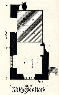 click to enlarge click to enlargeCW0177.jpg On p.378 of The Castles and Fortified Towers of Cumberland, Westmorland, and Lancashire North of the Sands, by John F Curwen. printed at bottom:- "Killington Hall:" item:- Armitt Library : A782.77 Image © see bottom of page |
|
|
|
||
| evidence:- | site plan:- Historical Monuments 1936 placename:- Killington Hall |
|
| source data:- | Site plan, uncoloured lithograph, Killington Hall, Killington, Westmorland, scale
about 1 to 290, published by Royal Commission on Historical Monuments England, London,
1936.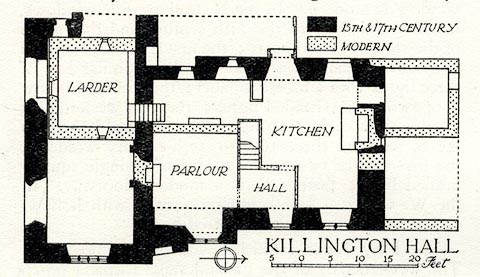 click to enlarge click to enlargeHMW085.jpg On p.132 of the Inventory of the Historical Monuments in Westmorland. printed, lower right "KILLINGTON HALL" RCHME no. Wmd, Killington 2 item:- Armitt Library : A745.85 Image © see bottom of page |
|
|
|
||
| evidence:- | database:- Listed Buildings 2010 placename:- Killington Hall item:- date stone (1640) |
|
| source data:- | courtesy of English Heritage "KILLINGTON HALL / / / KILLINGTON / SOUTH LAKELAND / CUMBRIA / II / 75691 / SD6129689007" |
|
|
|
||
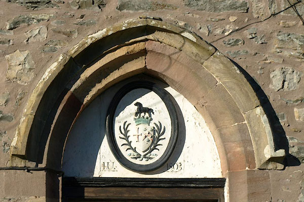 BTY71.jpg Hood moulding, coat of arms and date stone:- "I.U. 1803" (taken 28.1.2011) 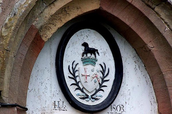 BMG54.jpg Coat of arms. (taken 16.6.2006) 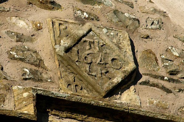 BTY72.jpg Date stone:- "P [ ] / TK / 1640 / LK" perhaps P for Pickering? (taken 28.1.2011) 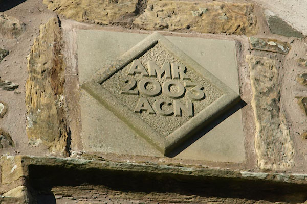 BTY73.jpg Date stone:- "AMR / 2003 / ACN" (taken 28.1.2011) 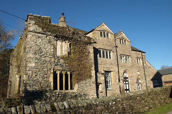 BTY70.jpg (taken 28.1.2011) |
||
|
|
||
| notes:- |
Believed built by Sir James de Pickering in the 15th century. Of this only the ruined
south wing remains. |
|
|
|
||
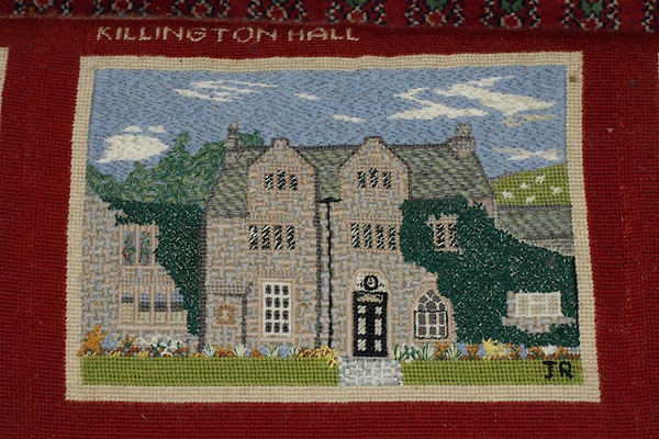 BTY90.jpg Embroidered kneeler, All Saints, Killington. (taken 28.1.2011) |
||
|
|
||
| notes:- |
15th century tower and later hall |
|
| Perriam, D R &Robinson, J: 1998: Medieval Fortified Buildings of Cumbria: CWAAS::
ISBN 1 873124 23 6; plan and illustration |
||
|
|
||
 Lakes Guides menu.