 Old Cumbria Gazetteer
 |
 |
|
| Broughton Moor Quarry, Broughton West | ||
| Broughton Moor Quarry | ||
| locality:- | Broughton Moor | |
| civil parish:- | Broughton West (formerly Lancashire) | |
| county:- | Cumbria | |
| locality type:- | slate quarry | |
| locality type:- | quarry | |
| locality type:- | workplace | |
| coordinates:- | SD25449456 (etc) | |
| 1Km square:- | SD2594 | |
| 10Km square:- | SD29 | |
|
|
||
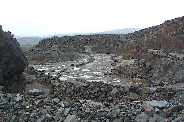 BMF96.jpg Current working level. (taken 12.6.2006) courtesy of the manager 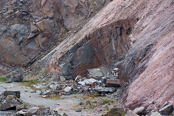 BMF97.jpg Working face. (taken 12.6.2006) courtesy of the manager |
||
|
|
||
| evidence:- | old map:- OS County Series (Lan 4) placename:- Lay Bank Quarry item:- slate |
|
| source data:- | Maps, County Series maps of Great Britain, scales 6 and 25
inches to 1 mile, published by the Ordnance Survey, Southampton,
Hampshire, from about 1863 to 1948. "Lay Bank Quarry (Slate)" |
|
|
|
||
| evidence:- | descriptive text:- Otley 1823 (5th edn 1834) item:- geology |
|
| source data:- | Guide book, A Concise Description of the English Lakes, the
mountains in their vicinity, and the roads by which they may be
visited, with remarks on the mineralogy and geology of the
district, by Jonathan Otley, published by the author, Keswick,
Cumberland now Cumbria, by J Richardson, London, and by Arthur
Foster, Kirkby Lonsdale, Cumbria, 1823; published 1823-49,
latterly as the Descriptive Guide to the English Lakes. goto source goto sourcePage 159:- "... Roofing slate (called black slate, to distinguish it from the pale-blue of the second division) is manufactured in large quantities in the district between Ulverston and Broughton; which is well situated for shipping either by the river Duddon or by canal from Ulverston." goto sourcePage 160:- "The preference given to the slates from certain quarries as requiring less weight for the covering of a roof of given dimensions, depends not so much upon the specific gravity (which varies at most from 2750 to 2800, or one part in 55) as upon the fineness of grain, which enables it to bear splitting thinner. ..." |
|
|
|
||
JandMN : 396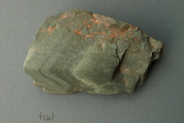 BXO37.jpg Rock, hand specimen of slate metamorphosed from tuff, from Broughton Moor Quarry, Broughton West, Cumberland, SD254945, 12 June 2006. Ordovician; Borrowdale Volcanic Group. (taken 12.6.2006) |
||
|
|
||
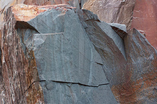 BMF99.jpg Slate, with sedimentation bands. (taken 12.6.2006) courtesy of the manager 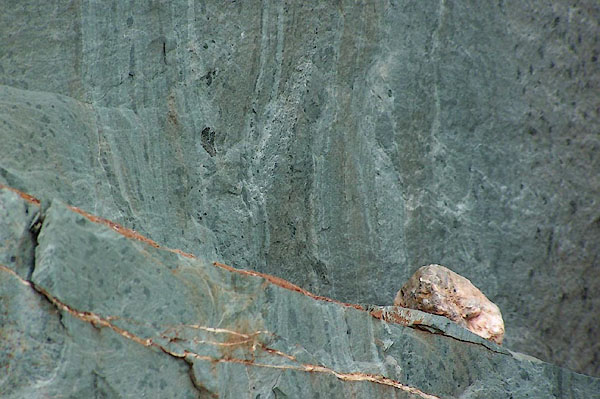 BMG01.jpg Slate, with sedimentation bands. (taken 12.6.2006) courtesy of the manager 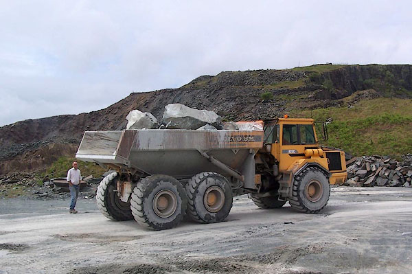 BMF98.jpg Dump truck moving ?waste. (taken 12.6.2006) courtesy of the manager 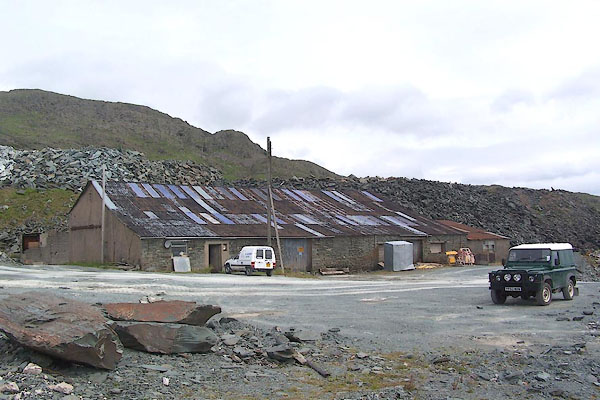 BMG02.jpg Quarry sheds. (taken 12.6.2006) courtesy of the manager 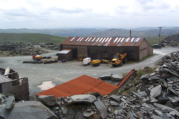 BMG03.jpg Quarry sheds. (taken 12.6.2006) courtesy of the manager 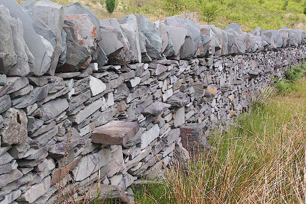 BMG04.jpg Stone wall, slate, on site boundary. (taken 12.6.2006) courtesy of the manager 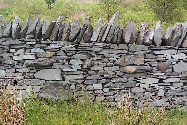 BMG05.jpg Stone wall, slate, on site boundary. (taken 12.6.2006) courtesy of the manager |
||
|
|
||
| Glover, David: 2014: Quarries of Lakeland: Bookcase (Carlisle, Cumbria) |
||
|
|
||
Lakes Guides menu.