 Old Cumbria Gazetteer
 |
 |
|
| Wythop Hall, Wythop | ||
| Wythop Hall | ||
| locality:- | Wythop | |
| civil parish:- | Wythop (formerly Cumberland) | |
| county:- | Cumbria | |
| locality type:- | buildings | |
| locality type:- | park | |
| locality type:- | castle (perhaps) | |
| coordinates:- | NY20312844 | |
| 1Km square:- | NY2028 | |
| 10Km square:- | NY22 | |
|
|
||
| evidence:- | old map:- OS County Series (Cmd 55 11) placename:- Wythop Hall |
|
| source data:- | Maps, County Series maps of Great Britain, scales 6 and 25
inches to 1 mile, published by the Ordnance Survey, Southampton,
Hampshire, from about 1863 to 1948. |
|
|
|
||
| evidence:- | old map:- Saxton 1579 placename:- Widehope |
|
| source data:- | Map, hand coloured engraving, Westmorlandiae et Cumberlandiae Comitatus ie Westmorland
and Cumberland, scale about 5 miles to 1 inch, by Christopher Saxton, London, engraved
by Augustinus Ryther, 1576, published 1579-1645.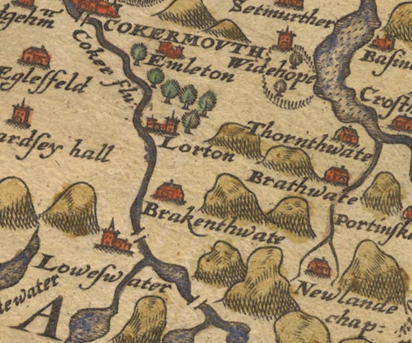 Sax9NY12.jpg Tower, symbol for a house, hall, tower, etc; in a ring of fence palings. "Widehope" item:- private collection : 2 Image © see bottom of page |
|
|
|
||
| evidence:- | old map:- Speed 1611 (Cmd) placename:- Widehope |
|
| source data:- | Map, hand coloured engraving, Cumberland and the Ancient Citie
Carlile Described, scale about 4 miles to 1 inch, by John Speed,
1610, published by J Sudbury and George Humble, Popes Head
Alley, London, 1611-12.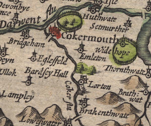 SP11NY12.jpg "Widehope" circle, tower, in a ring of fence palings item:- private collection : 16 Image © see bottom of page |
|
|
|
||
| evidence:- | old map:- Jansson 1646 placename:- Widehope |
|
| source data:- | Map, hand coloured engraving, Cumbria and Westmoria, ie
Cumberland and Westmorland, scale about 3.5 miles to 1 inch, by
John Jansson, Amsterdam, Netherlands, 1646. JAN3NY22.jpg "Widehope" Buildings and tower in a ring of fence palings with trees. item:- JandMN : 88 Image © see bottom of page |
|
|
|
||
| evidence:- | old map:- Morden 1695 (Cmd) |
|
| source data:- | Map, uncoloured engraving, Cumberland, scale about 4 miles to 1
inch, by Robert Morden, 1695, published by Abel Swale, the
Unicorn, St Paul's Churchyard, Awnsham, and John Churchill, the
Black Swan, Paternoster Row, London, 1695-1715.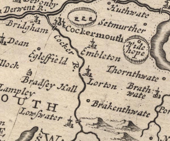 MD12NY12.jpg Marked within a ring of fence palings, trees. item:- JandMN : 90 Image © see bottom of page |
|
|
|
||
| evidence:- | old map:- Bowen and Kitchin 1760 |
|
| source data:- | Map, hand coloured engraving, A New Map of the Counties of
Cumberland and Westmoreland Divided into their Respective Wards,
scale about 4 miles to 1 inch, by Emanuel Bowen and Thomas
Kitchin et al, published by T Bowles, Robert Sayer, and John
Bowles, London, 1760.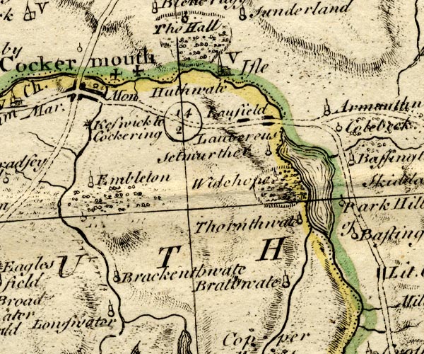 BO18NY12.jpg outline of fence palings, trees item:- Armitt Library : 2008.14.10 Image © see bottom of page |
|
|
|
||
| evidence:- | old map:- Donald 1774 (Cmd) |
|
| source data:- | Map, hand coloured engraving, 3x2 sheets, The County of Cumberland, scale about 1
inch to 1 mile, by Thomas Donald, engraved and published by Joseph Hodskinson, 29
Arundel Street, Strand, London, 1774.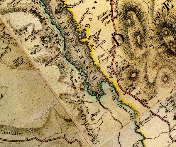 D4NY22NW.jpg "Hall" house item:- Carlisle Library : Map 2 Image © Carlisle Library |
|
|
|
||
| evidence:- | old text:- Gents Mag item:- licence to crenellate |
|
| source data:- | Magazine, The Gentleman's Magazine or Monthly Intelligencer or
Historical Chronicle, published by Edward Cave under the
pseudonym Sylvanus Urban, and by other publishers, London,
monthly from 1731 to 1922. goto source goto sourceGentleman's Magazine 1856 part 2 pp.323-330 "..." "LICENCES TO CRENELLATE, FROM THE PATENT ROLLS IN THE TOWER OF LONDON." "[Edward II continued]" "..." "12. Hugo de Louthre mansum suum de Wythehope in Derwente-felles ... Cumbr." "..." |
|
|
|
||
| evidence:- | text:- Curwen 1913 placename:- Wythope item:- licence to crenellate |
|
| source data:- | Book, The Castles and Fortified Towers of Cumberland,
Westmorland, and Lancashire North of the Sands, by John F
Curwen, published for the Cumberland and Westmorland Antiquarian
and Archaeological Society by Titus Wilson, Kendal, Westmorland,
1913. Licence to crenellate granted by Edward II; 12 Juy 1318:- "Hugo de Louthre ... mansum suum ... de Wythope in ... Derwentfelles, Cumberland." |
|
|
|
||
| evidence:- | database:- Listed Buildings 2010 placename:- Wythop Hall item:- date stone (1678) |
|
| source data:- | courtesy of English Heritage "WYTHOP HALL AND ADJOINING FORMER STABLES / / / WYTHOP / ALLERDALE / CUMBRIA / II / 72212 / NY2029128404" |
|
|
|
||
| hearsay:- |
Perhaps on the site of a house which Hugh de Lowther had a licence to crenellate 1318.
The rebuilding of 1678 includes none of this. |
|
|
|
||
| notes:- |
possible tower, demolished |
|
| Perriam, D R &Robinson, J: 1998: Medieval Fortified Buildings of Cumbria: CWAAS::
ISBN 1 873124 23 6 |
||
|
|
||
Lakes Guides menu.