 Old Cumbria Gazetteer
 |
 |
|
| Wythop Brows, Wythop | ||
| Wythop Brows | ||
| locality:- | Wythop | |
| civil parish:- | Wythop (formerly Cumberland) | |
| county:- | Cumbria | |
| locality type:- | hill | |
| 1Km square:- | NY2128 (etc) | |
| 10Km square:- | NY22 | |
|
|
||
| evidence:- | old map:- Ogilby 1675 (plate 96) |
|
| source data:- | Road strip map, hand coloured engraving, the Road from Kendal to
Cockermouth, and the Road from Egremond to Carlisle, scale about
1 inch to 1 mile, by John Ogilby, London, 1675.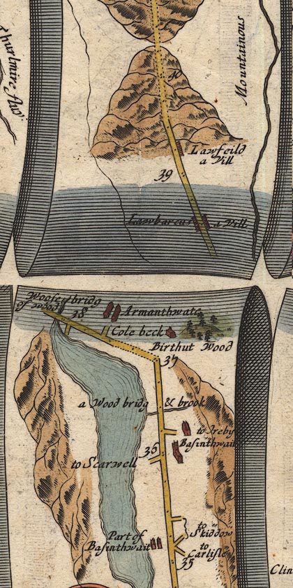 OG96m035.jpg In miles 35 to 38, Cumberland. Mountains beyond the lake on the left of the road for 3 miles. item:- JandMN : 22 Image © see bottom of page |
|
|
|
||
| evidence:- | old text:- Gents Mag placename:- Widehope Fells |
|
| source data:- | Magazine, The Gentleman's Magazine or Monthly Intelligencer or
Historical Chronicle, published by Edward Cave under the
pseudonym Sylvanus Urban, and by other publishers, London,
monthly from 1731 to 1922. goto source goto sourceGentleman's Magazine 1751 p.52 "... on the opposite side [of Bassenthwaite Lake] Widehope fells, with their impending woods, form a very pleasing and romantic appearance. ..." |
|
|
|
||
| evidence:- | old map:- Gents Mag 1751 placename:- Widehope Fells |
|
| source data:- | Map, uncoloured engraving, Map of the Black Lead Mines in
Cumberland, and area, scale about 2 miles to 1 inch, by George
Smith, published in the Gentleman's Magazine, 1751.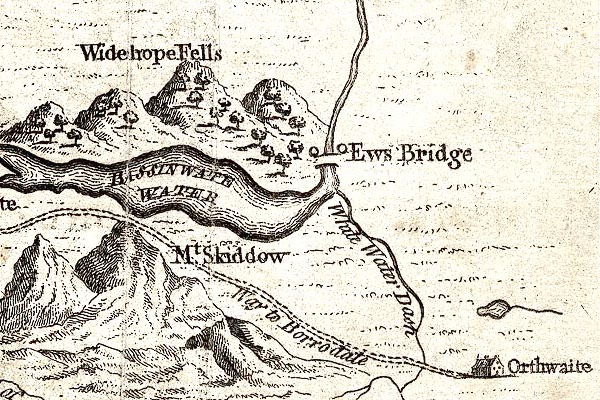 GM1313.jpg "Widehope Fells" knobbly hillocks; mountains, with woods item:- JandMN : 114 Image © see bottom of page |
|
|
|
||
| evidence:- | descriptive text:- West 1778 (11th edn 1821) placename:- Wythop Brows |
|
| source data:- | Guide book, A Guide to the Lakes, by Thomas West, published by
William Pennington, Kendal, Cumbria once Westmorland, and in
London, 1778 to 1821. goto source Page 121:- "... The whole western boundary [of Bassenthwaite Lake] is the noble range of wooded hills called Wythop-brows. ..." goto sourcePage 121:- "... Wythop-brows rise swift" goto sourcePage 122:- "from the water's edge. ..." |
|
|
|
||
| evidence:- | probably old map:- Garnett 1850s-60s H placename:- Wythop Fells |
|
| source data:- | Map of the English Lakes, in Cumberland, Westmorland and
Lancashire, scale about 3.5 miles to 1 inch, published by John
Garnett, Windermere, Westmorland, 1850s-60s.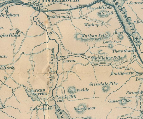 GAR2NY12.jpg "Wythop Fells" hill hachuring item:- JandMN : 82.1 Image © see bottom of page |
|
|
|
||
Lakes Guides menu.