 Old Cumbria Gazetteer
 |
 |
|
| Wythburn Fells, St John's Castlerigg etc | ||
| Wythburn Fells | ||
| civil parish:- | St John's Castlerigg and Wythburn (formerly Cumberland) | |
| county:- | Cumbria | |
| locality type:- | hill | |
| locality type:- | fell | |
| 1Km square:- | NY3112 | |
| 10Km square:- | NY31 | |
|
|
||
| evidence:- | old map:- Ogilby 1675 (plate 96) |
|
| source data:- | Road strip map, hand coloured engraving, the Road from Kendal to
Cockermouth, and the Road from Egremond to Carlisle, scale about
1 inch to 1 mile, by John Ogilby, London, 1675.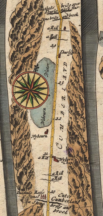 OG96m020.jpg In miles 20 to 27, Cumberland. Mountains on the left of the road for 7 miles. item:- JandMN : 22 Image © see bottom of page |
|
|
|
||
| evidence:- | roughly old map:- Clarke 1787 map (Ambleside to Keswick) placename:- Wytheburn Manor |
|
| source data:- | Map, A Map of the Roads Lakes etc between Keswick and Ambleside,
scale about 2.5 ins to 1 mile, by James Clarke, engraved by S J
Neele, 352 Strand, published by James Clarke, Penrith,
Cumberland and in London etc, 1787.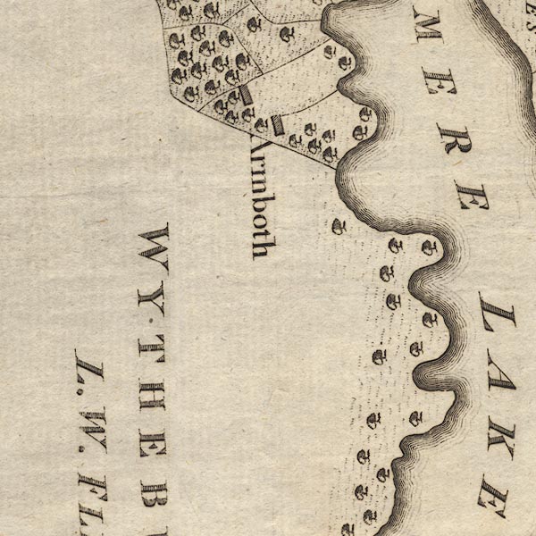 CL9NY31C.jpg 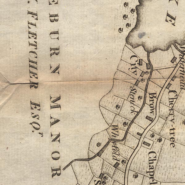 CL9NY31B.jpg "WYTHEBURN MANOR / L. W. FLETCHER ESQr." item:- private collection : 10.9 Image © see bottom of page |
|
|
|
||
| evidence:- | outline view:- Tattersall 1836 |
|
| source data:- | Print, engraving, View from Skiddaw, looking South, Cumberland, Westmorland and Lancashire,
drawn by George Tattersall, engraved by W F Topham, published by Sherwood and Co,
Paternoster Row, London, about 1836.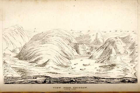 click to enlarge click to enlargeTAT137.jpg The print is captioned with mountain names and acts as an outline view. Tipped in opposite p.91 of The Lakes of England, by George Tattersall. printed at bottom:- "VIEW FROM SKIDDAW, / looking South. / [London Pubd. ...]" printed at p.91:- "... FOUR VIEWS FROM THE SUMMIT OF SKIDDAW. III. LOOKING SOUTH. / ... / 5. Wythburn, Cumberland. / ..." item:- Armitt Library : A1204.38 Image © see bottom of page |
|
|
|
||
 Lakes Guides menu.