 Old Cumbria Gazetteer
 |
 |
|
| Low Whineray Ground, Dunnerdale-with-Seathwaite | ||
| Low Whineray Ground | ||
| civil parish:- | Dunnerdale-with-Seathwaite (formerly Lancashire) | |
| county:- | Cumbria | |
| locality type:- | buildings | |
| coordinates:- | SD20109040 | |
| 1Km square:- | SD2090 | |
| 10Km square:- | SD29 | |
|
|
||
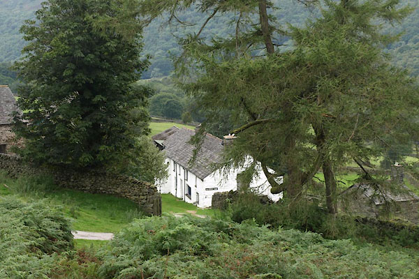 BXD78.jpg (taken 24.8.2012) |
||
|
|
||
| evidence:- | old map:- OS County Series (Lan 6 8) placename:- Low Whineray Ground placename:- Whineray Ground, Low |
|
| source data:- | Maps, County Series maps of Great Britain, scales 6 and 25
inches to 1 mile, published by the Ordnance Survey, Southampton,
Hampshire, from about 1863 to 1948. |
|
|
|
||
| evidence:- | old map:- Ford 1839 map placename:- Winnerah |
|
| source data:- | Map, uncoloured engraving, Map of the Lake District of
Cumberland, Westmoreland and Lancashire, scale about 3.5 miles
to 1 inch, published by Charles Thurnam, Carlisle, and by R
Groombridge, 5 Paternoster Row, London, 3rd edn 1843.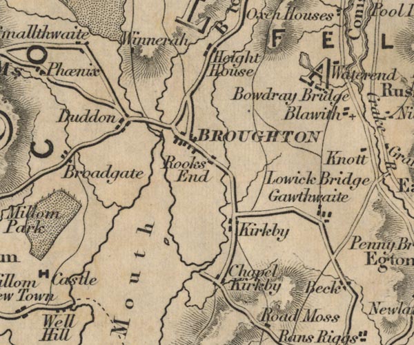 FD02SD28.jpg "Winnerah" item:- JandMN : 100.1 Image © see bottom of page |
|
|
|
||
| evidence:- | database:- Listed Buildings 2010 placename:- Low Whineray Ground |
|
| source data:- | courtesy of English Heritage "LOW WHINERAY GROUND, FARMHOUSE WITH ADJOINING BYRE, EARTH CLOSET AND CART SHED / / / DUNNERDALE WITH SEATHWAITE / SOUTH LAKELAND / CUMBRIA / II / 75844 / SD2010290407" |
|
|
|
||
 Lakes Guides menu.